
Suburb profile
Wolli Creek NSW 2205
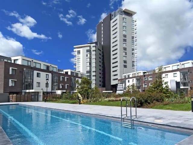
Wolli Creek is located in the Inner South West region of New South Wales, postcode 2205. It has 7,065 properties across 20 streets, almost all units. Explore every street in Wolli Creek, its property history, homes for sale and rent, who lives there, and the local agents.
About Wolli Creek
Wolli Creek, NSW 2205, sits in the Inner South West region and neighbours Turrella, Arncliffe, Earlwood and Marrickville. Its 20 streets hold 7,065 properties, 6,743 of them units and 322 houses.
At the 2021 Census Wolli Creek had 10,731 residents, a median age of 30 and an average household of 2.2 people. Median household income was $2,160 a week, the median mortgage repayment $2,383 a month and the median rent $540 a week. Of 4,629 dwellings, 4,518 were flats, 56 separate houses and 15 semi-detached; 2,902 were rented, 1,261 owned with a mortgage and 342 owned outright.
Updated October 2026
Who lives in Wolli Creek
- 10,731Peoplelive in the area
- 30Median ageyears
- $2,160Median household incomea week
- $540Median renta week
Homes by type
- Houses56
- Townhouses and semis15
- Flats and apartments4,518
Household
- Median mortgage repayment$2,383a month
- Household size2.2people on average
How homes are held
For sale and rent in Wolli Creek

 Leo Bo Liu

$750,000-$780,000
305/12 Brodie Spark Drive, Wolli Creek NSW 2205
 Matthew Turley

$700 Per Week
E105/35 Arncliffe Street, Wolli Creek NSW 2205
Inspect Wed, 28 Oct 4:15pm
Available Fri, 30 Oct
Properties in Wolli Creek

E105/35 Arncliffe Street
For rent since Sept 2026 · $700 per week
1 bedroom 1 bathroom 1 car space

305/12 Brodie Spark Drive
For sale since Sept 2026 · $750,000-$780,000
2 bedrooms 1 bathroom 1 car space

517/20 Chisholm Street
Leased Aug 2026 · $880 per week
2 bedrooms 1 bathroom

1504/26 Levey Street
Leased July 2026 · $930 per week
2 bedrooms 2 bathrooms 1 car space

903/20-23 Levey Street
Sold July 2026 · $940,000
2 bedrooms 2 bathrooms 2 car spaces

603/32-34 Levey Street
Leased July 2026 · $1,150 per week
3 bedrooms 2 bathrooms 1 car space

1101/15 Brodie Spark Drive
Leased July 2026 · $830 per week
1 bedroom 1 bathroom 1 car space

2004/9 Brodie Spark Drive
Sold Apr 2026 · Contact agent
2 bedrooms 2 bathrooms 1 car space 107 m² land
903/20-23 Levey Street
Sold July 2026 · $940,000
2 bedrooms 2 bathrooms 2 car spaces
2004/9 Brodie Spark Drive
Sold Apr 2026 · Contact agent
2 bedrooms 2 bathrooms 1 car space 107 m² land

1301/7 Magdalene Terrace
Sold Aug 2025 · $640,000
1 bedroom 1 bathroom

902/20 Brodie Spark Drive
Sold June 2025 · $700,000
1 bedroom 1 bathroom 1 car space 0 m² land

1011/1 Brodie Spark Drive
Sold Dec 2024 · $635,000
1 bedroom 1 bathroom 1 car space

1211/20 Chisholm Street
Sold Oct 2024 · Contact agent
1 bedroom 1 bathroom

509/99A Bonar Street
Sold Sept 2024 · $520,000
1 bathroom 1 car space

9 Brodie Spark Drive
Sold Aug 2024 · $610,000
1 bedroom 1 bathroom
Local agents in Wolli Creek


Joe Zhang
Principal / Accredited Auctioneer REMAX Infinity - Eastwood
Last 12 months
- Properties sold
- 18
- Median sold price
- $777k
- Median days on market
- 40

Jason Zhuang
Licensed Real Estate Agent McConnell Bourn Sydney
Last 12 months
- Properties sold
- 22
- Median sold price
- $982k
- Median days on market
- 8

Justin Ruan
Licensed Real Estate Agent McConnell Bourn Sydney
Last 12 months
- Properties sold
- 33
- Median sold price
- $982k
- Median days on market
- 29
Agencies that specialise in Wolli Creek

Streets in Wolli Creek
- Allen Street92 properties
- Ann Street108 properties
- Argyle Street12 properties
- Arncliffe Street1,272 properties
- Bonar Street673 properties
- Brodie Spark Drive1,485 properties
- Burrows Street1 property
- Chisholm Street657 properties
- Discovery Point Place105 properties
- Eden Street8 properties
- Gertrude Street577 properties
- Guess Avenue172 properties
- Innesdale Road171 properties
- Levey Street549 properties
- Lusty Street280 properties
- Magdalene Terrace299 properties
- Marsh Street99 properties
- Mount Olympus Boulevard62 properties
- Princes Highway138 properties
- Willis Street305 properties
Neighbouring suburbs
Addresses and streets incorporate or were developed using G-NAF © Geoscape Australia, licensed by the Commonwealth of Australia under the Open Geo-coded National Address File (G-NAF) End User Licence Agreement.
Population and housing figures are drawn from the Australian Bureau of Statistics, Census of Population and Housing 2021, licensed under Creative Commons Attribution 4.0 International.
Area summaries are generated from the national address file and ABS Census data, and checked against those figures before publication.