
Suburb profile
Tallai QLD 4213
Tallai is located in the Gold Coast region of Queensland, postcode 4213. It has 1,649 properties across 57 streets, mostly houses. Explore every street in Tallai, its property history, homes for sale and rent, who lives there, and the local agents.
About Tallai
Tallai, QLD 4213, sits in the Gold Coast region and neighbours Advancetown, Mudgeeraba, Worongary and Gilston. Its 57 streets hold 1,649 properties, 1,406 of them houses and 243 units.
Census figures are for Worongary - Tallai, which had 8,542 residents, a median age of 43 and an average household of 3.1 people. Median household income was $2,262 a week, the median mortgage repayment $2,200 a month and the median rent $520 a week. Of 2,539 dwellings, 2,383 were separate houses, 130 semi-detached and 24 flats; 910 were owned outright, 1,305 owned with a mortgage and 272 rented.
Updated October 2026
Who lives in Tallai
- 8,542Peoplelive in the area
- 43Median ageyears
- $2,262Median household incomea week
- $520Median renta week
Homes by type
- Houses2,383
- Townhouses and semis130
- Flats and apartments24
Household
- Median mortgage repayment$2,200a month
- Household size3.1people on average
How homes are held
For sale and rent in Tallai

 Charl Louw

AUCTION
11 Worongary Road, Tallai QLD 4213
Auction Wed, 11 Nov 6:00pm
 Charl Louw
All Offers and Expressions of Interest Due 4 Nov
64 Tallai Road, Tallai QLD 4213
Inspect today 3:00pm
 Charl Louw
EOI CLOSING 2/11/2026
38 Nature Valley Court, Tallai QLD 4213
Properties in Tallai
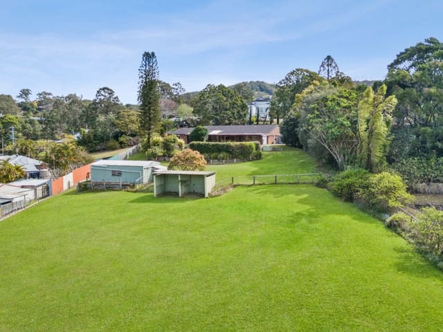
12 Veronica Drive
Sold Oct 2026 · Contact agent
5 bedrooms 2 bathrooms 2 car spaces 7,363 m² land

11 Worongary Road
For sale since Oct 2026 · AUCTION
5 bedrooms 2 bathrooms 15 car spaces 8,094 m² land

64 Tallai Road
For sale since Oct 2026 · All Offers and Expressions of Interest Due 4 Nov
6 bedrooms 3 bathrooms 6 car spaces 5,827 m² land

38 Nature Valley Court
For sale since Oct 2026 · EOI CLOSING 2/11/2026
4 bedrooms 2 bathrooms 8 car spaces 4,858 m² land

23 Bendigo Crescent
Sold Sept 2026 · $1,208,000
3 bedrooms 2 bathrooms 4 car spaces 875 m² land

35-37 Glenrowan Drive
For sale since Sept 2026 · $2.25m plus
5 bedrooms 2 bathrooms 4 car spaces 38,400 m² land

107 Tallai Road
For sale since Sept 2026 · $800,000 plus
6 bedrooms 4 bathrooms 4 car spaces 4,361 m² land

161 Mudgeeraba Road
For sale since Sept 2026 · UNDER CONTRACT - $1.6m plus
3 bedrooms 2 bathrooms 4 car spaces 7,979 m² land
12 Veronica Drive
Sold Oct 2026 · Contact agent
5 bedrooms 2 bathrooms 2 car spaces 7,363 m² land
23 Bendigo Crescent
Sold Sept 2026 · $1,208,000
3 bedrooms 2 bathrooms 4 car spaces 875 m² land
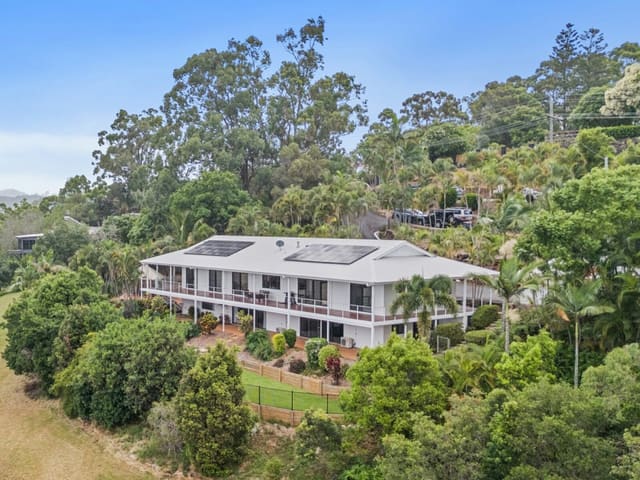
9 Earle Court
Sold Aug 2026 · $2,300,000
6 bedrooms 4 bathrooms 5 car spaces 6,858 m² land
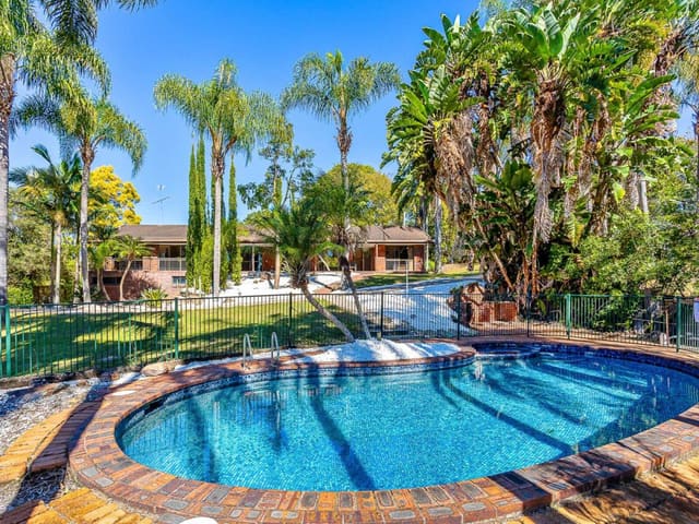
10 Veronica Drive
Sold Aug 2026 · $1,520,000
4 bedrooms 4 bathrooms 8 car spaces 4,927 m² land

4 Duke Court
Sold July 2026 · Contact agent
5 bedrooms 3 bathrooms 4 car spaces 4,000 m² land

33 Glenrowan Drive
Sold July 2026 · $1,890,000
6 bedrooms 3 bathrooms 7 car spaces 8,152 m² land

423 The Panorama
Sold July 2026 · $3,800,000
4 bedrooms 4 bathrooms 3 car spaces 32,500 m² land

1 Dulhunty Way
Sold June 2026 · $1,329,000
3 bedrooms 2 bathrooms 2 car spaces 789 m² land
Local agents in Tallai

Stuart Legg
Licenced Real Estate Agent | Ozlegg Trading Pty Ltd REMAX Regency - Robina
Last 12 months
- Properties sold
- 52
- Median sold price
- $1.58m
- Median days on market
- 50

Tori Nancarrow
Sales Associate | Ozlegg Trading Pty Ltd REMAX Regency - Robina
Last 12 months
- Properties sold
- 46
- Median sold price
- $1.58m
- Median days on market
- 50
Charl Louw
Licensed Real Estate Agent | DLRL Investments Pty Ltd REMAX Regency - Robina
Last 12 months
- Properties sold
- 39
- Median sold price
- $1.22m
- Median days on market
- 17
Agencies that specialise in Tallai


Streets in Tallai
A
B
C
D
E
F
G
H
I
L
M
N
O
P
R
S
T
U
V
W
X
Neighbouring suburbs
Addresses and streets incorporate or were developed using G-NAF © Geoscape Australia, licensed by the Commonwealth of Australia under the Open Geo-coded National Address File (G-NAF) End User Licence Agreement.
Population and housing figures are drawn from the Australian Bureau of Statistics, Census of Population and Housing 2021, licensed under Creative Commons Attribution 4.0 International.
Area summaries are generated from the national address file and ABS Census data, and checked against those figures before publication.