
Suburb profile
Rosetta TAS 7010
Rosetta is located in the Hobart region of Tasmania, postcode 7010. It has 1,492 properties across 40 streets, mostly houses. Explore every street in Rosetta, its property history, homes for sale and rent, who lives there, and the local agents.
About Rosetta
Rosetta, TAS 7010, sits in the Hobart region and neighbours Berriedale, Collinsvale and Montrose. Its 40 streets hold 1,492 properties, 1,071 of them houses and 421 units.
Census figures are for the Montrose - Rosetta area. It had 5,142 residents, a median age of 41 and an average household of 2.4 people. Median household income was $1,434 a week, the median mortgage repayment $1,448 a month and the median rent $350 a week. Of 2,037 dwellings, 1,663 were separate houses, 20 semi-detached, 350 flats and 8 other; 725 were owned outright, 681 owned with a mortgage and 579 rented.
Updated October 2026
Who lives in Rosetta
- 5,142Peoplelive in the area
- 41Median ageyears
- $1,434Median household incomea week
- $350Median renta week
Homes by type
- Houses1,663
- Townhouses and semis20
- Flats and apartments350
- Other8
Household
- Median mortgage repayment$1,448a month
- Household size2.4people on average
How homes are held
For sale and rent in Rosetta

 Marilyn Rooney

Offers Over $695,000
6 Marys Hope Road, Rosetta TAS 7010

 Aaron Murray
$795,000 +
13 Parramore Street, Rosetta TAS 7010
 Aaron Murray
$695,000 +
27 Driscoll Street, Rosetta TAS 7010
Properties in Rosetta

6 Marys Hope Road
For sale since Oct 2026 · Offers Over $695,000
3 bedrooms 1 bathroom 3 car spaces 574 m² land

13 Parramore Street
For sale since Oct 2026 · $795,000 +
3 bedrooms 1 bathroom 3 car spaces 698 m² land
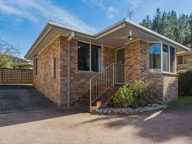
2/84 Marys Hope Road
Sold Sept 2026 · $512,000
2 bedrooms 1 bathroom 1 car space 210 m² land

27 Driscoll Street
For sale since Sept 2026 · $695,000 +
3 bedrooms 1 bathroom 3 car spaces 774 m² land

59C Marys Hope Road
For sale since Sept 2026 · $695,888 +
3 bedrooms 2 bathrooms 2 car spaces 989 m² land

12 Turnbull Crescent
Sold Aug 2026 · $785,000
5 bedrooms 2 bathrooms 5 car spaces 1,040 m² land

7A Stourton Street
Sold Apr 2026 · $717,500
3 bedrooms 2 bathrooms 1 car space

3 Mitchell Avenue
Sold Feb 2026 · Contact agent
3 bedrooms 1 bathroom 2 car spaces 599 m² land
2/84 Marys Hope Road
Sold Sept 2026 · $512,000
2 bedrooms 1 bathroom 1 car space 210 m² land
12 Turnbull Crescent
Sold Aug 2026 · $785,000
5 bedrooms 2 bathrooms 5 car spaces 1,040 m² land
7A Stourton Street
Sold Apr 2026 · $717,500
3 bedrooms 2 bathrooms 1 car space
3 Mitchell Avenue
Sold Feb 2026 · Contact agent
3 bedrooms 1 bathroom 2 car spaces 599 m² land

2/22 Glenmore Street
Sold Dec 2025 · $550,000
3 bedrooms 1 bathroom 95 m² land

39 Parramore Street
Sold Sept 2025 · $650,000
3 bedrooms 2 bathrooms 4 car spaces 542 m² land

546 Main Road
Sold Aug 2025 · $680,000
3 bedrooms 1 bathroom 3 car spaces 592 m² land

11 Turnbull Crescent
Sold Aug 2025 · $640,000
4 bedrooms 2 bathrooms 4 car spaces 1,040 m² land
Schools in Rosetta
Rosetta Primary School
GovernmentPrimary
Montrose Bay High School
GovernmentSecondary
Local agents in Rosetta

Ladence Tandukar
Personal Assistant to Aaron Murray 4one4 Property Co.
Last 12 months
- Properties sold
- 147
- Median sold price
- $650k
- Median days on market
- 28
Aaron Murray
Sales Agent 4one4 Property Co.
Last 12 months
- Properties sold
- 153
- Median sold price
- $650k
- Median days on market
- 28

Patrick Berry
Manager 4one4 Property Co.
Last 12 months
- Properties sold
- 13
- Median sold price
- $440k
- Median days on market
- 28
Agencies that specialise in Rosetta
Streets in Rosetta
- Addison Street39 properties
- Alroy Court37 properties
- Apollo Road16 properties
- Barclay Crescent30 properties
- Basque Place12 properties
- Brooker Highway19 properties
- Carter Court7 properties
- Cordelia Court41 properties
- Crosby Court5 properties
- Crosby Road82 properties
- Dodson Street11 properties
- Dooleys Avenue22 properties
- Driscoll Street46 properties
- Gentile Court25 properties
- Glenmore Street35 properties
- Gould Crescent8 properties
- Gunn Court14 properties
- Hardman Court5 properties
- Hone Road22 properties
- Katoomba Crescent44 properties
- Lorraine Crescent23 properties
- Main Road62 properties
- Marys Hope Road317 properties
- Mascot Court9 properties
- Mclean Court18 properties
- Mitchell Avenue18 properties
- Officer Street28 properties
- Parramore Street49 properties
- Peacock Court21 properties
- Radcliff Crescent87 properties
- Redlands Drive28 properties
- Riverview Parade44 properties
- Sherwin Court15 properties
- Simpson Place22 properties
- Stourton Street37 properties
- Strathaven Drive66 properties
- Tarcombe Street21 properties
- Taylor Court25 properties
- Turnbull Crescent34 properties
- Walker Street48 properties
Neighbouring suburbs
Addresses and streets incorporate or were developed using G-NAF © Geoscape Australia, licensed by the Commonwealth of Australia under the Open Geo-coded National Address File (G-NAF) End User Licence Agreement.
Population and housing figures are drawn from the Australian Bureau of Statistics, Census of Population and Housing 2021, licensed under Creative Commons Attribution 4.0 International.
School details © Australian Curriculum, Assessment and Reporting Authority (ACARA), from the Australian Schools List, licensed under Creative Commons Attribution 4.0 International and modified. ACARA does not endorse Listd.
Area summaries are generated from the national address file and ABS Census data, and checked against those figures before publication.