
Suburb profile
Peregian Beach QLD 4573
Peregian Beach is located in the Sunshine Coast region of Queensland, postcode 4573. It has 3,513 properties across 89 streets. Explore every street in Peregian Beach, its property history, homes for sale and rent, who lives there, and the local agents.
About Peregian Beach
Peregian Beach, QLD 4573, sits in the Sunshine Coast region and neighbours Coolum Beach, Doonan, Noosaville and Peregian Springs. Its 89 streets hold 3,513 properties, 2,272 of them houses and 1,241 units.
Census figures are for the Peregian Beach - Marcus Beach area, which covers 0.802 of the suburb. The area had 4,107 residents, a median age of 46 and an average household of 2.4 people. Median household income was $1,755 a week, the median mortgage repayment $2,100 a month and the median rent $455 a week. Of 1,591 dwellings, 1,198 were separate houses, 259 semi-detached and 125 flats; 625 were owned outright, 517 owned with a mortgage and 414 rented.
Updated October 2026
Who lives in Peregian Beach
- 4,107Peoplelive in the area
- 46Median ageyears
- $1,755Median household incomea week
- $455Median renta week
Homes by type
- Houses1,198
- Townhouses and semis259
- Flats and apartments125
Household
- Median mortgage repayment$2,100a month
- Household size2.4people on average
How homes are held
For sale and rent in Peregian Beach
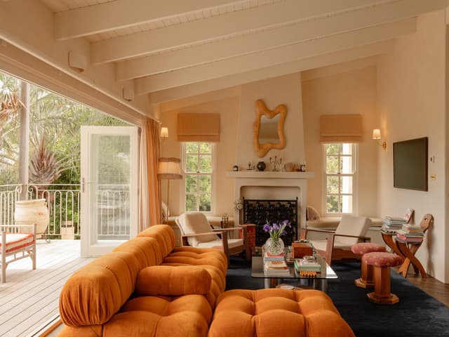
 Adrian Reed

WEDNESDAY 25TH NOVEMBER AT 1PM
40 Lowry Street, Peregian Beach QLD 4573
Inspect Sat, 31 Oct 12:30pm
Auction Wed, 25 Nov 1:00pm

 Sheridan Hodgetts
OFFERS OVER $1,695,000
1/15 Martin Street, Peregian Beach QLD 4573
Inspect Sat, 31 Oct 11:00am

 Joel Nicholls

Auction
18 Jacana Street, Peregian Beach QLD 4573
Auction Thu, 29 Oct 5:00pm
Properties in Peregian Beach

40 Lowry Street
For sale since Oct 2026 · WEDNESDAY 25TH NOVEMBER AT 1PM
3 bedrooms 3 bathrooms 3 car spaces 992 m² land

2 Jamaica Street
Sold Oct 2026 · $1,600,000
4 bedrooms 2 bathrooms 2 car spaces 599 m² land

1/15 Martin Street
For sale since Oct 2026 · OFFERS OVER $1,695,000
3 bedrooms 1 bathroom 1 car space 129 m² land

18 Jacana Street
For sale since Sept 2026 · Auction
2 bedrooms 3 bathrooms 1 car space 531 m² land

3/16 Pelican Street
Leased Sept 2026 · $1,050 per week
3 bedrooms 2 bathrooms 2 car spaces

33 Shearwater Street
For sale since Sept 2026 · For Sale
2 bedrooms 1 bathroom 1 car space 511 m² land

93 Clarendon Road
For sale since Sept 2026 · Auction
3 bedrooms 1 bathroom 2 car spaces 4.94 ac land
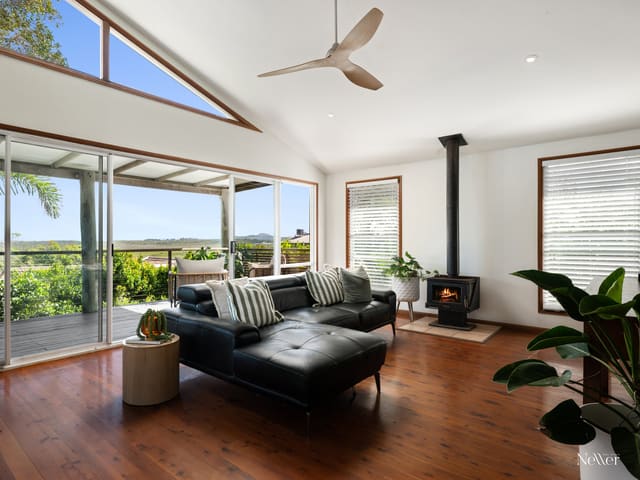
9 Cormorant Crescent
Sold Sept 2026 · $2,000,000
5 bedrooms 3 bathrooms 2 car spaces 562 m² land
2 Jamaica Street
Sold Oct 2026 · $1,600,000
4 bedrooms 2 bathrooms 2 car spaces 599 m² land
9 Cormorant Crescent
Sold Sept 2026 · $2,000,000
5 bedrooms 3 bathrooms 2 car spaces 562 m² land

2/48-50 Plover Street
Sold Sept 2026 · Contact agent
2 bedrooms 2 bathrooms 1 car space
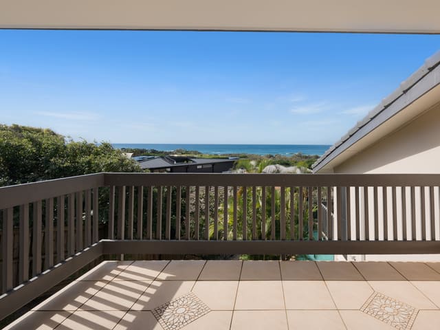
5/28 Peregian Esplanade
Sold Aug 2026 · $1,415,000
2 bedrooms 2 bathrooms 1 car space

46 California Boulevard
Sold July 2026 · Contact agent
5 bedrooms 2 bathrooms 2 car spaces 450 m² land

32 California Boulevard
Sold July 2026 · $1,050,000
4 bedrooms 2 bathrooms 2 car spaces 375 m² land

9/2 Peregian Esplanade
Sold May 2026 · Contact agent
3 bedrooms 2 bathrooms 1 car space 166 m² land

2/312 David Low Way
Sold May 2026 · Contact agent
2 bedrooms 1 bathroom 1 car space
Schools in Peregian Beach
Peregian Beach College
IndependentPrimary and secondary
Peregian Beach College
IndependentPrimary and secondary
Local agents in Peregian Beach

Robbie Neller
Director / Sales Agent Neller Real Estate
Last 12 months
- Properties sold
- 59
- Median sold price
- $1.7m
- Median days on market
- 41
Joel Nicholls
Sales Agent Neller Real Estate
Last 12 months
- Properties sold
- 41
- Median sold price
- $1.28m
- Median days on market
- 37

Paddy O'Rourke
Sales Agent Neller Real Estate
Last 12 months
- Properties sold
- 15
- Median sold price
- $1.62m
- Median days on market
- 43
Agencies that specialise in Peregian Beach
All 5 agencies in Peregian Beach
Streets in Peregian Beach
A
B
C
D
E
F
G
H
I
J
K
L
- Lake Vista Drive35 properties
- Lakeshore Place26 properties
- Lakewood Drive20 properties
- Lancewood Avenue26 properties
- Landrail Street15 properties
- Long Board Street42 properties
- Lorikeet Drive193 properties
- Lorilet Street49 properties
- Lowan Crescent4 properties
- Lowry Street68 properties
- Lyrebird Court18 properties
M
N
O
P
- Paldao Rise16 properties
- Parakeet Crescent66 properties
- Pavonia Street15 properties
- Pelican Street75 properties
- Peregian Breeze Drive68 properties
- Peregian Esplanade270 properties
- Persimmon Drive41 properties
- Petrel Street28 properties
- Pipeline Avenue46 properties
- Piper Street36 properties
- Pitta Street11 properties
- Plover Street63 properties
- Podargus Parade77 properties
R
S
T
V
W
Neighbouring suburbs
Addresses and streets incorporate or were developed using G-NAF © Geoscape Australia, licensed by the Commonwealth of Australia under the Open Geo-coded National Address File (G-NAF) End User Licence Agreement.
Population and housing figures are drawn from the Australian Bureau of Statistics, Census of Population and Housing 2021, licensed under Creative Commons Attribution 4.0 International.
School details © Australian Curriculum, Assessment and Reporting Authority (ACARA), from the Australian Schools List, licensed under Creative Commons Attribution 4.0 International and modified. ACARA does not endorse Listd.
Area summaries are generated from the national address file and ABS Census data, and checked against those figures before publication.