
Suburb profile
Clayfield QLD 4011
Clayfield is located in the Brisbane Inner City region of Queensland, postcode 4011. It has 7,620 properties across 111 streets. Explore every street in Clayfield, its property history, homes for sale and rent, who lives there, and the local agents.
About Clayfield
Clayfield, QLD 4011, sits in the Brisbane Inner City region and neighbours Albion, Ascot, Hendra and Kalinga. Its 111 streets hold 7,620 properties, 3,597 of them houses and 4,023 units.
At the 2021 Census Clayfield had 10,754 residents, a median age of 37 and an average household of 2.2 people. Median household income was $1,931 a week, the median mortgage repayment $2,000 a month and the median rent $350 a week. Of 4,693 dwellings, 1,744 were separate houses, 494 semi-detached, 2,440 flats and 9 other; 1,138 were owned outright, 1,430 owned with a mortgage and 2,024 rented.
Updated October 2026
Who lives in Clayfield
- 10,754Peoplelive in the area
- 37Median ageyears
- $1,931Median household incomea week
- $350Median renta week
Homes by type
- Houses1,744
- Townhouses and semis494
- Flats and apartments2,440
- Other9
Household
- Median mortgage repayment$2,000a month
- Household size2.2people on average
How homes are held
For sale and rent in Clayfield

 Oliver Jonker

Auction On-Site 8am Sat 14th November
31 Dublin Street, Clayfield QLD
Inspect Thu, 29 Oct 5:00pm
Auction Sat, 14 Nov 8:00am

 Mario Lattanzi
$875,000
1/8 Gellibrand Street, Clayfield QLD

 Jordan Cleland
$799,000
5/4 Garnet Street, Clayfield QLD

 Grace Duce

$775 Per Week
4/4 Garnet Street, Clayfield QLD
Available Fri, 20 Nov

 Michaela Hully
$690 pw
1/89 Riverton Street, Clayfield QLD
Available now

 Property Management Team
$700 pw
2/33 Franz Road, Clayfield QLD
Available Fri, 30 Oct
Properties in Clayfield

1/12 Ford Street
Leased Nov 2026 · $600 per week
2 bedrooms 1 bathroom 1 car space 91 m² land

10/15 Junction Road
Leased Nov 2026 · $700 per week
2 bedrooms 1 bathroom 2 car spaces 182 m² land

7/44 Montpelier Street
Leased Oct 2026 · $660 per week
2 bedrooms 1 bathroom 107 m² land

4/34 Wagner Road
Leased Oct 2026 · $680 per week
2 bedrooms 2 bathrooms 1 car space

22 Oriel Road
Sold Oct 2026 · $1,100,000
3 bedrooms 1 bathroom 2 car spaces 362 m² land

30 Mcgregor Street
Leased Oct 2026 · $750 per week
3 bedrooms 1 bathroom 476 m² land

31 Dublin Street
For sale since Oct 2026 · Auction On-Site 8am Sat 14th November
5 bedrooms 2 bathrooms 2 car spaces 443 m² land

1/8 Gellibrand Street
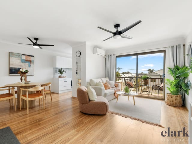
For sale since Oct 2026 · $875,000
2 bedrooms 2 bathrooms 1 car space
22 Oriel Road
Sold Oct 2026 · $1,100,000
3 bedrooms 1 bathroom 2 car spaces 362 m² land

3/65 Stuckey Road
Sold Oct 2026 · $900,000
3 bedrooms 1 bathroom 1 car space
7/42 Alma Road
Sold Oct 2026 · $760,000
2 bedrooms 1 bathroom 1 car space

4/16 Bonney Avenue
Sold Sept 2026 · $769,000
2 bedrooms 2 bathrooms 1 car space

4/41 Reeve Street
Sold Aug 2026 · $775,000
2 bedrooms 1 bathroom 2 car spaces 845 m² land

2/75 Wagner Road
Sold Aug 2026 · $1,160,000
3 bedrooms 2 bathrooms 1 car space

4/546 Sandgate Road
Sold Aug 2026 · $702,000
2 bedrooms 1 bathroom 1 car space

2/53 Alma Road
Sold July 2026 · $740,000
2 bedrooms 1 bathroom 1 car space
Schools in Clayfield
Clayfield College
IndependentPrimary and secondary
Eagle Junction State School
GovernmentPrimary
St Agatha's Primary School
CatholicPrimary
St Rita's College
CatholicPrimary and secondary
Clayfield College
IndependentPrimary and secondary
St Rita's College
CatholicPrimary and secondary
Local agents in Clayfield

Shenal Yigitbas
Real Estate Agent Harcourts Solutions - Windsor
Last 12 months
- Properties sold
- 29
- Median sold price
- $865k
- Median days on market
- 23
Mario Lattanzi
Principal Clark Real Estate
Last 12 months
- Properties sold
- 46
- Median sold price
- $817k
- Median days on market
- 48
Jordan Cleland
Sales Manager Clark Real Estate
Last 12 months
- Properties sold
- 56
- Median sold price
- $830k
- Median days on market
- 45
Agencies that specialise in Clayfield
All 14 agencies in Clayfield
Streets in Clayfield
A
B
- Balmain Street1 property
- Barlow Street166 properties
- Bartley Street4 properties
- Batman Street30 properties
- Bayview Terrace136 properties
- Beaufort Lane8 properties
- Bellevue Terrace146 properties
- Bonney Avenue512 properties
- Boston Street41 properties
- Botany Street44 properties
- Bourne Street35 properties
- Brentwood Street12 properties
- Brooke Street11 properties
- Burrell Street21 properties
- Butler Street1 property
C
D
E
F
G
H
J
K
L
M
N
O
P
Q
R
S
T
U
V
W
Neighbouring suburbs
Addresses and streets incorporate or were developed using G-NAF © Geoscape Australia, licensed by the Commonwealth of Australia under the Open Geo-coded National Address File (G-NAF) End User Licence Agreement.
Population and housing figures are drawn from the Australian Bureau of Statistics, Census of Population and Housing 2021, licensed under Creative Commons Attribution 4.0 International.
School details © Australian Curriculum, Assessment and Reporting Authority (ACARA), from the Australian Schools List, licensed under Creative Commons Attribution 4.0 International and modified. ACARA does not endorse Listd.
Area summaries are generated from the national address file and ABS Census data, and checked against those figures before publication.