
Suburb profile
Balgal Beach QLD 4816
Balgal Beach is located in the Townsville region of Queensland, postcode 4816. It has 818 properties across 35 streets, almost all houses. Explore every street in Balgal Beach, its property history, homes for sale and rent, who lives there, and the local agents.
About Balgal Beach
Balgal Beach, QLD 4816, sits in the Townsville region and neighbours Clemant, Coral Sea and Rollingstone. Its 35 streets hold 818 properties, 766 of them houses and 52 units.
Census figures are for the Northern Beaches area, which had 6,566 residents, a median age of 45 and an average household of 2.5 people. Median household income was $1,531 a week, the median mortgage repayment $1,600 a month and the median rent $300 a week. Of 2,394 dwellings, 2,284 were separate houses, 19 semi-detached, 77 other and none flats; 851 were owned outright, 1,111 owned with a mortgage and 348 rented.
Updated October 2026
Who lives in Balgal Beach
- 6,566Peoplelive in the area
- 45Median ageyears
- $1,531Median household incomea week
- $300Median renta week
Homes by type
- Houses2,284
- Townhouses and semis19
- Other77
Household
- Median mortgage repayment$1,600a month
- Household size2.5people on average
How homes are held
For sale and rent in Balgal Beach

 Allison Gough

$535,000
185 Balgal Beach Road, Balgal Beach QLD 4816
Properties in Balgal Beach
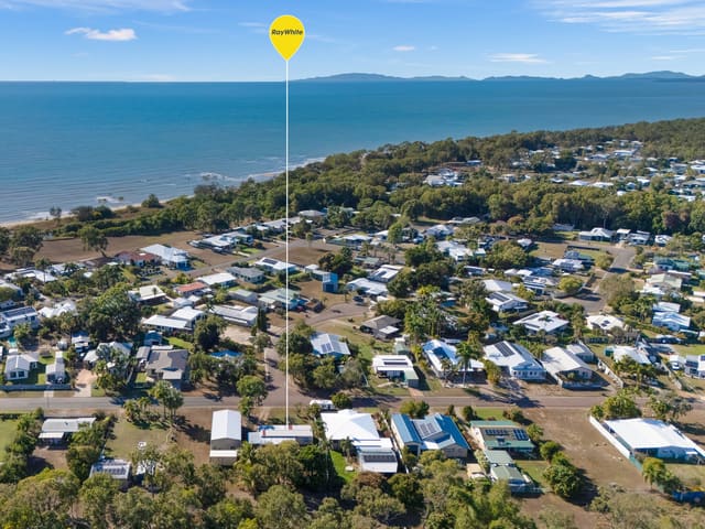
15 Borton Street
Sold Sept 2026 · $328,000
2 bedrooms 1 bathroom 1 car space 812 m² land

166 Ocean Parade
Sold Sept 2026 · $491,000
3 bedrooms 1 bathroom 1 car space 800 m² land

59 Esplanade
Sold Sept 2026 · $715,000
2 bedrooms 1 bathroom 4 car spaces 809 m² land

185 Balgal Beach Road
For sale since Sept 2026 · $535,000
3 bedrooms 2 bathrooms 2 car spaces 809 m² land

15 Fanning Court
Sold July 2026 · $627,000
4 bedrooms 2 bathrooms 1 car space 847 m² land

27 Madelaine Drive
Sold July 2026 · $500,000
4 bedrooms 2 bathrooms 2 car spaces 915 m² land

16 Tracey Street
Sold July 2026 · $485,000
800 m² land

73 Mystic Avenue
Sold July 2026 · $532,000
3 bedrooms 1 bathroom 4 car spaces 4,600 m² land
15 Borton Street
Sold Sept 2026 · $328,000
2 bedrooms 1 bathroom 1 car space 812 m² land
166 Ocean Parade
Sold Sept 2026 · $491,000
3 bedrooms 1 bathroom 1 car space 800 m² land
59 Esplanade
Sold Sept 2026 · $715,000
2 bedrooms 1 bathroom 4 car spaces 809 m² land
15 Fanning Court
Sold July 2026 · $627,000
4 bedrooms 2 bathrooms 1 car space 847 m² land
27 Madelaine Drive
Sold July 2026 · $500,000
4 bedrooms 2 bathrooms 2 car spaces 915 m² land
16 Tracey Street
Sold July 2026 · $485,000
800 m² land
73 Mystic Avenue
Sold July 2026 · $532,000
3 bedrooms 1 bathroom 4 car spaces 4,600 m² land

198 Balgal Beach Road
Sold July 2026 · Contact agent
3 bedrooms 1 bathroom 2 car spaces 950 m² land
Local agents in Balgal Beach
Allison Gough
Licensed Real Estate Agent Ray White Townsville
Last 12 months
- Properties sold
- 81
- Median sold price
- $708k
- Median days on market
- 46
Last 12 months
- Properties sold
- 11
- Median sold price
- $700k
- Median days on market
- 56

Dakota Clarke
Sales Agent Ray White Townsville
Last 12 months
- Properties sold
- 33
- Median sold price
- $720k
- Median days on market
- 52

Agencies that specialise in Balgal Beach


Streets in Balgal Beach
- Acheron Drive41 properties
- Armidale Avenue18 properties
- Augusta Drive51 properties
- Balgal Beach Road110 properties
- Beach Court1 property
- Borton Street31 properties
- Cole Court6 properties
- Community Crescent6 properties
- Esplanade43 properties
- Fanning Court13 properties
- Fitzpatrick Court10 properties
- Howitson Drive53 properties
- Jose Maria Court4 properties
- Justin Street11 properties
- Lound Road1 property
- Macor Court6 properties
- Madelaine Drive30 properties
- Marlin Street58 properties
- Medinah Court16 properties
- Mystic Avenue121 properties
- O'Connor Road11 properties
- Ocean Parade74 properties
- Pace Road1 property
- Pebble Beach Court7 properties
- Rollo Court7 properties
- Silkjar Street1 property
- The Vines Court10 properties
- Toogood Street1 property
- Tooth Street3 properties
- Tracey Street26 properties
- Trevina Court4 properties
- Turnberry Court14 properties
- Twist Court6 properties
- Virginia Court17 properties
- Wild Dunes Court6 properties
Neighbouring suburbs
Addresses and streets incorporate or were developed using G-NAF © Geoscape Australia, licensed by the Commonwealth of Australia under the Open Geo-coded National Address File (G-NAF) End User Licence Agreement.
Population and housing figures are drawn from the Australian Bureau of Statistics, Census of Population and Housing 2021, licensed under Creative Commons Attribution 4.0 International.
Area summaries are generated from the national address file and ABS Census data, and checked against those figures before publication.