
Suburb profile
Woolloomooloo NSW 2011
Woolloomooloo is located in the Sydney City and Inner South region of New South Wales, postcode 2011. It has 4,340 properties across 36 streets, mostly units. Explore every street in Woolloomooloo, its property history, homes for sale and rent, who lives there, and the local agents.
About Woolloomooloo
Woolloomooloo, NSW 2011, sits in the Sydney City and Inner South region and neighbours Darlinghurst, Potts Point and Sydney. Its 36 streets hold 4,340 properties, 904 of them houses and 3,436 units.
Census figures are for the Potts Point - Woolloomooloo area. It had 18,187 residents, a median age of 39 and an average household of 1.5 people. Median household income was $2,041 a week, the median mortgage repayment $2,500 a month and the median rent $490 a week. Of 10,076 dwellings, 8,979 were flats, 949 semi-detached, 34 separate houses and 62 other; 6,457 were rented, 1,810 owned outright and 1,581 owned with a mortgage.
Updated October 2026
Who lives in Woolloomooloo
- 18,187Peoplelive in the area
- 39Median ageyears
- $2,041Median household incomea week
- $490Median renta week
Homes by type
- Houses34
- Townhouses and semis949
- Flats and apartments8,979
- Other62
Household
- Median mortgage repayment$2,500a month
- Household size1.5people on average
How homes are held
For sale and rent in Woolloomooloo
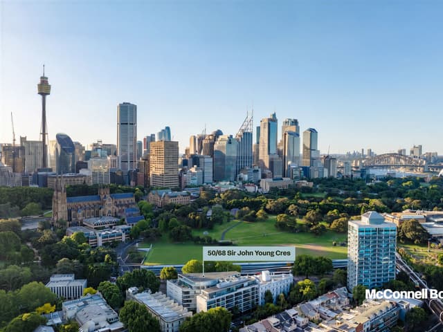
 Eva Jingwen Wang

New to Market
50/68 Sir John Young Crescent, Woolloomooloo NSW 2011
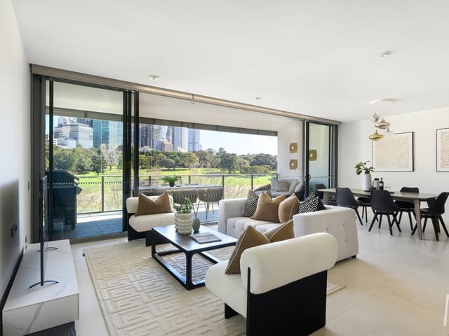
 Leo Bo Liu
Contact Agent
76/68 Sir John Young Crescent, Woolloomooloo NSW 2011
Properties in Woolloomooloo

50/68 Sir John Young Crescent
For sale since Oct 2026 · New to Market
3 bedrooms 2 bathrooms 2 car spaces

76/68 Sir John Young Crescent
For sale since Oct 2026 · Contact agent
3 bedrooms 2 bathrooms 2 car spaces

302/6E Cowper Wharf Roadway
Leased May 2026 · $1,200 per week
1 bedroom 1 bathroom 1 car space

908/63 Crown Street
Sold Feb 2026 · Contact agent
3 bedrooms 2 bathrooms 3 car spaces 203 m² land

5/85 Bourke Street
Leased · $700 per week
1 bedroom 1 bathroom 1 car space 0 m² land

25/85 Bourke Street
Leased · $530 per week
1 bedroom 1 bathroom 0 m² land

514/6E Cowper Wharf Roadway
Leased · $990 per week
1 bedroom 1 bathroom 1 car space 0 m² land

313/76-88 Crown Street
Leased · Contact agent
3 bedrooms 2 bathrooms 1 car space 0 m² land
Schools in Woolloomooloo
Plunkett Street Public School
GovernmentPrimary
Sydney Distance Education High School
GovernmentSecondary
William Street Campus
CatholicSecondary
Local agents in Woolloomooloo


Elicia Murray
Property Partner Ben Collier of The Agency
Last 12 months
- Properties sold
- 5
- Median sold price
- $4.75m
- Median days on market
- 56

Ben Collier
Co-Founder Ben Collier of The Agency
Last 12 months
- Properties sold
- 24
- Median sold price
- $4.5m
- Median days on market
- 35

Sofia Tianzhuo Qu
Senior Sales Executive McConnell Bourn Hills District
Last 12 months
- Properties sold
- 44
- Median sold price
- $950k
- Median days on market
- 31
Agencies that specialise in Woolloomooloo

Streets in Woolloomooloo
- Best Street20 properties
- Bland Street10 properties
- Boomerang Place260 properties
- Bourke Street211 properties
- Brougham Street252 properties
- Broughton Street8 properties
- Cathedral Street284 properties
- Charles Street23 properties
- Corfu Street7 properties
- Cowper Wharf Roadway722 properties
- Crown Street276 properties
- Dowling Street445 properties
- Faucett Lane5 properties
- Forbes Street334 properties
- Griffiths Street20 properties
- Harmer Street27 properties
- Judge Street26 properties
- Junction Lane2 properties
- Kidmans Terrace7 properties
- Lincoln Crescent126 properties
- Mcelhone Street188 properties
- Nicholson Street36 properties
- Palmer Street139 properties
- Plunkett Street9 properties
- Rae Place11 properties
- Riley Street54 properties
- Robinson Street5 properties
- Sir John Young Crescent223 properties
- St Kilda Lane4 properties
- Stephen Street25 properties
- Sydney Place1 property
- Talbot Place2 properties
- Turner Lane5 properties
- William Lane5 properties
- William Street564 properties
- Windeyer Street4 properties
Neighbouring suburbs
Addresses and streets incorporate or were developed using G-NAF © Geoscape Australia, licensed by the Commonwealth of Australia under the Open Geo-coded National Address File (G-NAF) End User Licence Agreement.
Population and housing figures are drawn from the Australian Bureau of Statistics, Census of Population and Housing 2021, licensed under Creative Commons Attribution 4.0 International.
School details © Australian Curriculum, Assessment and Reporting Authority (ACARA), from the Australian Schools List, licensed under Creative Commons Attribution 4.0 International and modified. ACARA does not endorse Listd.
Area summaries are generated from the national address file and ABS Census data, and checked against those figures before publication.