
Suburb profile
West Moonah TAS 7009
West Moonah is located in the Hobart region of Tasmania, postcode 7009. It has 2,242 properties across 58 streets, mostly houses. Explore every street in West Moonah, its property history, homes for sale and rent, who lives there, and the local agents.
About West Moonah
West Moonah, TAS 7009, sits in the Hobart region and neighbours Glenorchy, Moonah and Lenah Valley. Its 58 streets hold 2,242 properties, 1,540 of them houses and 702 units.
At the census West Moonah had 4,398 residents, a median age of 34 and an average household of 2.6 people. Median household income was $1,494 a week, the median mortgage repayment $1,430 a month and the median rent $340 a week. Of 1,679 dwellings, 1,340 were separate houses, 129 semi-detached and 206 flats; 466 were owned outright, 489 owned with a mortgage and 689 rented.
Updated October 2026
Who lives in West Moonah
- 4,398Peoplelive in the area
- 34Median ageyears
- $1,494Median household incomea week
- $340Median renta week
Homes by type
- Houses1,340
- Townhouses and semis129
- Flats and apartments206
Household
- Median mortgage repayment$1,430a month
- Household size2.6people on average
How homes are held
For sale and rent in West Moonah

 Laurie Gray

Offers over $615,000
1 / 16-17 Kiren Court, West Moonah TAS 7009

 Damien Hollingsworth
Offers over $775,000
1 / 3 Mayhill Court, West Moonah TAS 7009
Properties in West Moonah

1/16-17 Kiren Court
For sale since Oct 2026 · Offers over $615,000
3 bedrooms 1 bathroom 2 car spaces 280 m² land
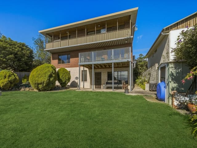
59 Ashbourne Grove
Sold Sept 2026 · $900,000
5 bedrooms 2 bathrooms 4 car spaces 470 m² land

1/3 Mayhill Court
For sale since Aug 2026 · Offers over $775,000
4 bedrooms 2 bathrooms 2 car spaces 432 m² land

40 Amy Street
Sold July 2026 · $390,000
4 bedrooms 2 bathrooms 2 car spaces 817 m² land

12 Sixth Avenue
Sold July 2026 · $600,000
2 bedrooms 1 bathroom 3 car spaces 274 m² land

10A Wylie Crescent
Sold July 2026 · Contact agent
404 m² land

2/79 Ripley Road
Sold June 2026 · $660,000
3 bedrooms 1 bathroom 2 car spaces 322 m² land

46 Corinda Grove
Sold Dec 2025 · $655,000
2 bedrooms 1 bathroom 2 car spaces 587 m² land
59 Ashbourne Grove
Sold Sept 2026 · $900,000
5 bedrooms 2 bathrooms 4 car spaces 470 m² land
40 Amy Street
Sold July 2026 · $390,000
4 bedrooms 2 bathrooms 2 car spaces 817 m² land
12 Sixth Avenue
Sold July 2026 · $600,000
2 bedrooms 1 bathroom 3 car spaces 274 m² land
10A Wylie Crescent
Sold July 2026 · Contact agent
404 m² land
2/79 Ripley Road
Sold June 2026 · $660,000
3 bedrooms 1 bathroom 2 car spaces 322 m² land
46 Corinda Grove
Sold Dec 2025 · $655,000
2 bedrooms 1 bathroom 2 car spaces 587 m² land

7 Tenth Avenue
Sold Oct 2025 · $850,000
4 bedrooms 2 bathrooms 2 car spaces 675 m² land

48 Twelfth Avenue
Sold Oct 2025 · $860,000
6 bedrooms 2 bathrooms 4 car spaces
Schools in West Moonah
Hilliard Christian School
IndependentPrimary and secondary
Springfield Gardens Primary School
GovernmentPrimary
Hilliard Christian School
IndependentPrimary and secondary
St Francis Flexible School
CatholicSpecial
Local agents in West Moonah

Martin Evans
Real Estate Agent 4one4 Property Co.
Last 12 months
- Properties sold
- 24
- Median sold price
- $635k
- Median days on market
- 22

John McGregor
Real Estate Agent 4one4 Property Co.
Last 12 months
- Properties sold
- 29
- Median sold price
- $610k
- Median days on market
- 32

Ladence Tandukar
Personal Assistant to Aaron Murray 4one4 Property Co.
Last 12 months
- Properties sold
- 147
- Median sold price
- $650k
- Median days on market
- 28
Agencies that specialise in West Moonah
Streets in West Moonah
A
B
C
D
E
F
G
K
L
M
N
P
R
S
T
V
W
Neighbouring suburbs
Addresses and streets incorporate or were developed using G-NAF © Geoscape Australia, licensed by the Commonwealth of Australia under the Open Geo-coded National Address File (G-NAF) End User Licence Agreement.
Population and housing figures are drawn from the Australian Bureau of Statistics, Census of Population and Housing 2021, licensed under Creative Commons Attribution 4.0 International.
School details © Australian Curriculum, Assessment and Reporting Authority (ACARA), from the Australian Schools List, licensed under Creative Commons Attribution 4.0 International and modified. ACARA does not endorse Listd.
Area summaries are generated from the national address file and ABS Census data, and checked against those figures before publication.