
Suburb profile
Roleystone WA 6111
Roleystone is located in the Perth South East region of Western Australia, postcode 6111. It has 2,984 properties across 156 streets, almost all houses. Explore every street in Roleystone, its property history, homes for sale and rent, who lives there, and the local agents.
About Roleystone
Roleystone, WA 6111, sits in the Perth South East region and neighbours Ashendon, Bedfordale, Karragullen and Kelmscott. Its 156 streets hold 2,984 properties, 2,898 of them houses and 86 units.
At the 2021 Census Roleystone had 7,243 residents, a median age of 44 and an average household of 2.7 people. Median household income was $2,185 a week, the median mortgage repayment $2,056 a month and the median rent $350 a week. Of 2,585 dwellings, 2,539 were separate houses, 39 semi-detached and 4 flats; 986 were owned outright, 1,374 owned with a mortgage and 178 rented.
Updated October 2026
Who lives in Roleystone
- 7,243Peoplelive in the area
- 44Median ageyears
- $2,185Median household incomea week
- $350Median renta week
Homes by type
- Houses2,539
- Townhouses and semis39
- Flats and apartments4
Household
- Median mortgage repayment$2,056a month
- Household size2.7people on average
How homes are held
For sale and rent in Roleystone

 Mark Grogan

From $1,350,000
50A Croyden Road, Roleystone WA
Properties in Roleystone

50A Croyden Road
For sale since Oct 2026 · From $1,350,000
3 bedrooms 2 bathrooms 4 car spaces 2,005 m² land

5 Zavatteri Rise
Sold Sept 2026 · $490,000
2,667 m² land

140 Irymple Road
Sold Sept 2026 · $1,200,000
3 bedrooms 2 bathrooms 4,047 m² land

101 Soldiers Road
Sold July 2026 · $1,610,000
4 bedrooms 3 bathrooms 2 car spaces 4,110 m² land

1 Sanctuary Court
Sold July 2026 · $1,800,000
5 bedrooms 3 bathrooms 6 car spaces 2,290 m² land

16 Tyers Road
Sold Apr 2026 · $1,085,000
4 bedrooms 1 bathroom 3 car spaces 1,996 m² land

102 Heritage Drive
Sold Feb 2026 · $1,490,000
4 bedrooms 2 bathrooms 4 car spaces 2,037 m² land

64 Holden Road
Sold Feb 2026 · $1,200,000
3 bedrooms 1 bathroom 10 car spaces 1,949 m² land
5 Zavatteri Rise
Sold Sept 2026 · $490,000
2,667 m² land
140 Irymple Road
Sold Sept 2026 · $1,200,000
3 bedrooms 2 bathrooms 4,047 m² land
101 Soldiers Road
Sold July 2026 · $1,610,000
4 bedrooms 3 bathrooms 2 car spaces 4,110 m² land
1 Sanctuary Court
Sold July 2026 · $1,800,000
5 bedrooms 3 bathrooms 6 car spaces 2,290 m² land
16 Tyers Road
Sold Apr 2026 · $1,085,000
4 bedrooms 1 bathroom 3 car spaces 1,996 m² land
102 Heritage Drive
Sold Feb 2026 · $1,490,000
4 bedrooms 2 bathrooms 4 car spaces 2,037 m² land
64 Holden Road
Sold Feb 2026 · $1,200,000
3 bedrooms 1 bathroom 10 car spaces 1,949 m² land
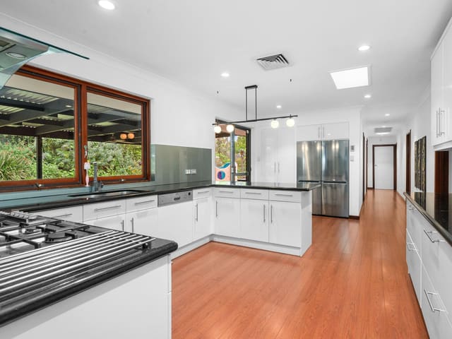
1 Barbigal Road
Sold Dec 2025 · $1,140,000
3 bedrooms 2 bathrooms 2 car spaces 1,843 m² land
Schools in Roleystone
Roleystone Community College
GovernmentPrimary and secondary
Roleystone Community College
GovernmentPrimary and secondary
Local agents in Roleystone
Mark Grogan
Sales Representative O'Neil Real Estate
Last 12 months
- Properties sold
- 162
- Median sold price
- $820k
- Median days on market
- 29

Matthew Quinn
Sales Associate - Mark Grogan Team O'Neil Real Estate
Last 12 months
- Properties sold
- 2
- Median sold price
- $490k
- Median days on market
- 16

Brian O'Neil
Commercial Sales & Leasing Representative O'Neil Real Estate
Last 12 months
- Properties sold
- 11
- Median sold price
- $840k
- Median days on market
- 33
Agencies that specialise in Roleystone
Streets in Roleystone
A
B
- Barbara Road12 properties
- Barbigal Road2 properties
- Barnes Road25 properties
- Beales Court7 properties
- Belvedere Rise14 properties
- Berrima Road8 properties
- Bettenay Road9 properties
- Birtwistle Place23 properties
- Blackett Court5 properties
- Brockway Road2 properties
- Brooks Road25 properties
- Brookton Highway119 properties
- Brownley Court5 properties
- Buchanan Road17 properties
- Butcher Road20 properties
C
- Calliandra Place14 properties
- Calytrix Road11 properties
- Canning Dam Road1 property
- Canning Mills Road13 properties
- Caprea Boulevard9 properties
- Catspaw Chase16 properties
- Chevin Road29 properties
- Churchman Brook Road1 property
- Coachmans Place8 properties
- Collins Road2 properties
- Contour Road45 properties
- Convine Road3 properties
- Costata Cove15 properties
- Cottage Lane1 property
- Country Club Avenue13 properties
- Coventry Road26 properties
- Croasdale Road13 properties
- Croyden Road95 properties
D
E
F
G
H
- Hall Road37 properties
- Hart Street2 properties
- Hassett Road8 properties
- Hawkins Road23 properties
- Hawkstone Road54 properties
- Heath Road44 properties
- Heather Road17 properties
- Hellenic Road12 properties
- Henty Lookout21 properties
- Heritage Drive100 properties
- High Road17 properties
- Hill Road13 properties
- Hilton Road20 properties
- Holden Road82 properties
- Hookway Crescent15 properties
- Horsemans View6 properties
I
J
K
L
M
- Mackie Road53 properties
- Maclean Street17 properties
- Madew Street2 properties
- Mann Place13 properties
- Marden Place4 properties
- Mcness Drive1 property
- Merton Road4 properties
- Michael Road31 properties
- Mirfield Street11 properties
- Misty Valley View4 properties
- Moseri Road15 properties
- Mount Dale View13 properties
N
O
P
R
S
- Salicina Gardens20 properties
- Sanctuary Court11 properties
- Sawmill Place8 properties
- Scilla Place6 properties
- Sefton Road10 properties
- Simons Drive41 properties
- Slab Gully Road32 properties
- Soldiers Road58 properties
- Sollya Court5 properties
- Sophia Grove17 properties
- Spring Road5 properties
- Springdale Road3 properties
- Stocker Road8 properties
- Stonegate Road5 properties
- Stony Brook Lane7 properties
- Surman Place6 properties
T
U
V
W
Z
Neighbouring suburbs
Addresses and streets incorporate or were developed using G-NAF © Geoscape Australia, licensed by the Commonwealth of Australia under the Open Geo-coded National Address File (G-NAF) End User Licence Agreement.
Population and housing figures are drawn from the Australian Bureau of Statistics, Census of Population and Housing 2021, licensed under Creative Commons Attribution 4.0 International.
School details © Australian Curriculum, Assessment and Reporting Authority (ACARA), from the Australian Schools List, licensed under Creative Commons Attribution 4.0 International and modified. ACARA does not endorse Listd.
Area summaries are generated from the national address file and ABS Census data, and checked against those figures before publication.