
Suburb profile
Northbridge WA 6003
Northbridge is located in the Inner Perth region of Western Australia, postcode 6003. It has 1,718 properties across 23 streets. Explore every street in Northbridge, its property history, homes for sale and rent, who lives there, and the local agents.
About Northbridge
Northbridge, WA 6003, sits in Inner Perth and neighbours West Perth and Perth. Its 23 streets hold 1,718 properties, 605 of them houses and 1,113 units.
Census figures are for the Perth (West) - Northbridge area, which covers the whole suburb. It had 12,119 residents, a median age of 33 and an average household of 1.7 people. Median household income was $1,966 a week, the median mortgage repayment $1,840 a month and the median rent $410 a week. Of 5,363 dwellings, 5,244 were flats, 82 semi-detached and 27 separate houses; 632 were owned outright, 900 owned with a mortgage and 3,713 rented.
Updated October 2026
Who lives in Northbridge
- 12,119Peoplelive in the area
- 33Median ageyears
- $1,966Median household incomea week
- $410Median renta week
Homes by type
- Houses27
- Townhouses and semis82
- Flats and apartments5,244
Household
- Median mortgage repayment$1,840a month
- Household size1.7people on average
How homes are held
For sale and rent in Northbridge

 Dan Sharp

Offers above $499,000
9/103-105 Francis Street, Northbridge WA

 Mitchel Currie

Please Call For Details
406 / 403 Newcastle Street, Northbridge WA 6003
Properties in Northbridge
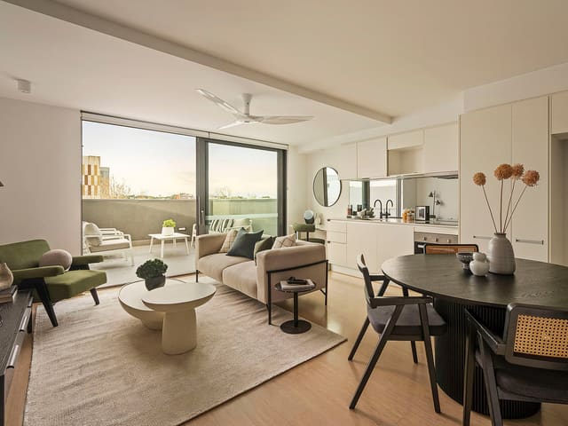
4/89 Aberdeen Street
Sold Oct 2026 · $605,000
2 bedrooms 2 bathrooms 1 car space

4/5 Antonas Road
Leased Sept 2026 · $640 per week
1 bedroom 1 bathroom 1 car space

26/269 James Street
Leased Sept 2026 · $750 per week
1 bedroom 1 bathroom 1 car space

19/98 Lake Street
Leased Sept 2026 · $725 per week
2 bedrooms 2 bathrooms 1 car space

203/403 Newcastle Street
Leased Aug 2026 · $770 per week
2 bedrooms 2 bathrooms 1 car space

9/103-105 Francis Street
For sale since July 2026 · Offers above $499,000
1 bedroom 1 bathroom 1 car space 1,103 m² land

3/321 Newcastle Street
Sold July 2026 · $975,000
3 bedrooms 2 bathrooms 2 car spaces

1/43 Shenton Street
Sold June 2026 · Contact agent
2 bedrooms 2 bathrooms 1 car space 149 m² land
4/89 Aberdeen Street
Sold Oct 2026 · $605,000
2 bedrooms 2 bathrooms 1 car space
3/321 Newcastle Street
Sold July 2026 · $975,000
3 bedrooms 2 bathrooms 2 car spaces
1/43 Shenton Street
Sold June 2026 · Contact agent
2 bedrooms 2 bathrooms 1 car space 149 m² land

16/134 Aberdeen Street
Sold Oct 2025 · $627,000
2 bedrooms 2 bathrooms 1 car space

56/134 Aberdeen Street
Sold July 2025 · $585,000
2 bedrooms 2 bathrooms 1 car space

203/403 Newcastle Street
Sold June 2025 · $498,500
2 bedrooms 2 bathrooms 1 car space 97 m² land

22/5 Antonas Road
Sold Dec 2024 · $660,000
2 bedrooms 2 bathrooms 1 car space

3A/305 William Street
Sold Aug 2024 · $720,000
2 bedrooms 1 bathroom 1 car space 137 m² land
Local agents in Northbridge

Rhiannon Hodge
Executive Assistant to Brad Triplett Arena Real Estate Agents
Last 12 months
- Properties sold
- 6
- Median sold price
- $625k
- Median days on market
- 35


Jack Patterson
Sales Executive Claremont
Last 12 months
- Properties sold
- 8
- Median sold price
- $543k
- Median days on market
- 51


Marius Bonev
Sales Executive Abel Property Sales
Last 12 months
- Properties sold
- 12
- Median sold price
- $778k
- Median days on market
- 11
Agencies that specialise in Northbridge
All 6 agencies in NorthbridgeMack Hall Real Estate - in association with Knight Frank
Claremont WA 6010, Australia, Claremont, WA 6010
Streets in Northbridge
- Aberdeen Street271 properties
- Antonas Road45 properties
- Davies Street17 properties
- Errichetti Place24 properties
- Fitzgerald Street84 properties
- Francis Street97 properties
- James Street440 properties
- John Street37 properties
- Kakulas Crescent7 properties
- Lake Street93 properties
- Little Shenton Lane47 properties
- Melbourne Street3 properties
- Milligan Street3 properties
- Newcastle Street229 properties
- Palmerston Street10 properties
- Parker Street31 properties
- Roe Street60 properties
- Serich Lane6 properties
- Shenton Street82 properties
- Via Torre21 properties
- Via Torre Lane21 properties
- Vita Loop3 properties
- William Street87 properties
Neighbouring suburbs
Addresses and streets incorporate or were developed using G-NAF © Geoscape Australia, licensed by the Commonwealth of Australia under the Open Geo-coded National Address File (G-NAF) End User Licence Agreement.
Population and housing figures are drawn from the Australian Bureau of Statistics, Census of Population and Housing 2021, licensed under Creative Commons Attribution 4.0 International.
Area summaries are generated from the national address file and ABS Census data, and checked against those figures before publication.