
Suburb profile
North Ryde NSW 2113
North Ryde is located in the Ryde region of New South Wales, postcode 2113. It has 6,826 properties across 109 streets. Explore every street in North Ryde, its property history, homes for sale and rent, who lives there, and the local agents.
About North Ryde
North Ryde, NSW 2113, sits in the Ryde region and neighbours East Ryde, Macquarie Park, Ryde and Lindfield. Its 109 streets hold 6,826 properties, 4,178 of them houses and 2,648 units.
Census figures are for North Ryde - East Ryde, which covers most of the suburb. The area had 15,622 residents, a median age of 38 and an average household of 2.7 people. Median household income was $2,439 a week, the median mortgage repayment $2,800 a month and the median rent $521 a week. Of 5,503 dwellings, 3,400 were separate houses, 564 semi-detached and 1,531 flats, with 4 other. Tenure split into 1,669 owned outright, 1,836 owned with a mortgage and 1,875 rented.
Updated October 2026
Who lives in North Ryde
- 15,622Peoplelive in the area
- 38Median ageyears
- $2,439Median household incomea week
- $521Median renta week
Homes by type
- Houses3,400
- Townhouses and semis564
- Flats and apartments1,531
- Other4
Household
- Median mortgage repayment$2,800a month
- Household size2.7people on average
How homes are held
For sale and rent in North Ryde

 Andrew Gee

Auction, Unless Sold Prior.
17 Blenheim Road, North Ryde NSW 2113
Inspect Sat, 31 Oct 1:00pm
Auction Sat, 28 Nov 2:00pm
 Morison Shang

$700 Per Week
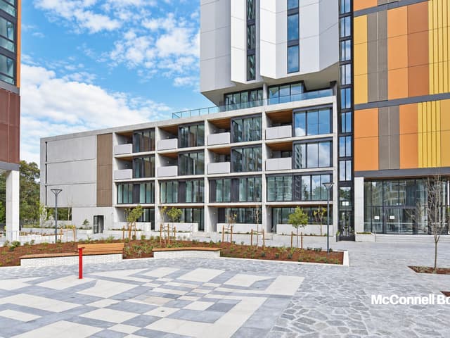
B612/3 Network Place, North Ryde NSW 2113
Inspect tomorrow 5:30pm
Available Wed, 11 Nov
Properties in North Ryde

17 Blenheim Road
For sale since Oct 2026 · Auction, Unless Sold Prior.
5 bedrooms 3 bathrooms 6 car spaces 700 m² land

26 Chauvel Street
Leased Oct 2026 · $850 per week
3 bedrooms 1 bathroom 1 car space

11 Kent Road
Sold June 2026 · Contact agent
4 bedrooms 2 bathrooms 2 car spaces

140A Epping Road
Leased Apr 2026 · Contact agent
5 bedrooms 4 bathrooms 2 car spaces

99 Coxs Road
Leased Mar 2026 · $1,050 per week
4 bedrooms 2 bathrooms 4 car spaces 852 m² land

58 David Avenue
Sold Apr 2025 · $3,680,000
5 bedrooms 3 bathrooms 2 car spaces 734 m² land

185 Coxs Road
Leased Mar 2025 · $675 per week
2 bedrooms 1 bathroom 2 car spaces

12/5A Whiteside Street
Sold Feb 2025 · $618,000
1 bedroom 1 bathroom 136 m² land
11 Kent Road
Sold June 2026 · Contact agent
4 bedrooms 2 bathrooms 2 car spaces
58 David Avenue
Sold Apr 2025 · $3,680,000
5 bedrooms 3 bathrooms 2 car spaces 734 m² land
12/5A Whiteside Street
Sold Feb 2025 · $618,000
1 bedroom 1 bathroom 136 m² land

7 David Avenue
Sold Nov 2024 · $3,046,000
6 bedrooms 3 bathrooms 2 car spaces

31 Wilson Street
Sold Sept 2024 · $3,366,000
5 bedrooms 3 bathrooms 4 car spaces 657.6 m² land

204/1 Network Place
Sold Sept 2024 · $660,000
1 bedroom 1 bathroom 1 car space 74 m² land

312/5A Whiteside Street
Sold Apr 2024 · $835,000
2 bedrooms 2 bathrooms 1 car space

1410/3 Network Place
Sold Dec 2023 · $640,000
1 bedroom 1 bathroom 1 car space
Schools in North Ryde
Holy Spirit Catholic Primary School
CatholicPrimary
North Ryde Public School
GovernmentPrimary
Ryde East Public School
GovernmentPrimary
The Children's House Montessori
IndependentPrimary
Truscott Street Public School
GovernmentPrimary
No secondary schools in North Ryde.
Arndell School
GovernmentSpecial
Agencies that specialise in North Ryde
All 7 agencies in North Ryde

Streets in North Ryde
A
B
- Badajoz Road103 properties
- Baringa Street27 properties
- Barr Street30 properties
- Beatrice Street63 properties
- Berripa Close50 properties
- Berryman Street24 properties
- Beswick Avenue87 properties
- Betty Hendry Parade53 properties
- Blamey Street14 properties
- Blenheim Road86 properties
- Bond Street10 properties
- Brendon Street9 properties
- Bridge Road77 properties
C
- Cam Lane2 properties
- Cam Street61 properties
- Carramar Avenue12 properties
- Cave Avenue27 properties
- Chauvel Street34 properties
- Chisholm Street28 properties
- Clarence Street23 properties
- Collins Street7 properties
- Conrad Street57 properties
- Cook Street51 properties
- Cooney Street54 properties
- Coxs Road277 properties
- Cressy Road76 properties
- Cutler Parade50 properties
D
E
F
G
H
I
J
K
L
M
N
O
P
R
S
T
W
Neighbouring suburbs
Addresses and streets incorporate or were developed using G-NAF © Geoscape Australia, licensed by the Commonwealth of Australia under the Open Geo-coded National Address File (G-NAF) End User Licence Agreement.
Population and housing figures are drawn from the Australian Bureau of Statistics, Census of Population and Housing 2021, licensed under Creative Commons Attribution 4.0 International.
School details © Australian Curriculum, Assessment and Reporting Authority (ACARA), from the Australian Schools List, licensed under Creative Commons Attribution 4.0 International and modified. ACARA does not endorse Listd.
Area summaries are generated from the national address file and ABS Census data, and checked against those figures before publication.