
Suburb profile
Lynbrook VIC 3975
Lynbrook is located in the South East Melbourne region of Victoria, postcode 3975. It has 3,328 properties across 148 streets, almost all houses. Explore every street in Lynbrook, its property history, homes for sale and rent, who lives there, and the local agents.
About Lynbrook
Lynbrook, VIC 3975, sits in South East Melbourne and neighbours Cranbourne North, Hampton Park, Lyndhurst and Dandenong South. Its 148 streets hold 3,328 properties, 3,064 of them houses and 264 units.
Census figures are for Lynbrook - Lyndhurst, which had 18,027 residents, a median age of 33 and an average household of 3.5 people. Median household income was $2,330 a week, the median mortgage repayment $2,080 a month and the median rent $416 a week. Of 4,933 dwellings, 4,626 were separate houses, 283 semi-detached and 28 flats; 723 were owned outright, 3,113 owned with a mortgage and 997 rented.
Updated October 2026
Who lives in Lynbrook
- 18,027Peoplelive in the area
- 33Median ageyears
- $2,330Median household incomea week
- $416Median renta week
Homes by type
- Houses4,626
- Townhouses and semis283
- Flats and apartments28
Household
- Median mortgage repayment$2,080a month
- Household size3.5people on average
How homes are held
Properties in Lynbrook

22 Baynton Crescent
Leased Sept 2026 · $680 per week
4 bedrooms 2 bathrooms 2 car spaces 664 m² land
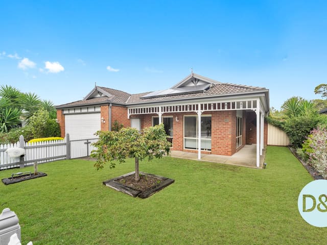
57 Henry Lawson Drive
Sold June 2026 · Contact agent
4 bedrooms 2 bathrooms 2 car spaces 625 m² land
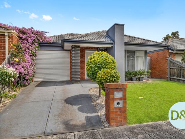
3 Rankin Close
Sold Dec 2025 · $720,000
3 bedrooms 2 bathrooms 1 car space 301 m² land

3 Campion Walk
Sold Mar 2025 · $705,000
2 bedrooms 2 bathrooms 2 car spaces 437.751 m² land
Schools in Lynbrook
Lynbrook Primary School
GovernmentPrimary
St Francis de Sales Catholic Primary School
CatholicPrimary
No secondary schools in Lynbrook.
Local agents in Lynbrook


Ben Doughton
Director D & J Property Co
Last 12 months
- Properties sold
- 14
- Median sold price
- $705k
- Median days on market
- 31
Last 12 months
- Properties sold
- 9
- Median sold price
- $610k
- Median days on market
- 48

Last 12 months
- Properties sold
- 6
- Median sold price
- $610k


Agencies that specialise in Lynbrook
Streets in Lynbrook
A
B
- Banjo Circuit50 properties
- Bay Laurel Close11 properties
- Baynton Crescent40 properties
- Beaver Terrace8 properties
- Bingham Rise12 properties
- Blue Range Crescent27 properties
- Bodhran Place7 properties
- Boldrewood Place17 properties
- Bollinger Lane1 property
- Bonwick Close8 properties
- Boothby Terrace17 properties
- Braddon Way7 properties
- Brady Close14 properties
- Buckley Way10 properties
- Bushman Way16 properties
- Business Park Drive10 properties
C
- Campion Walk4 properties
- Carboni Crescent40 properties
- Cathedral Court10 properties
- Cato Parkway53 properties
- Caversham Terrace46 properties
- Chapel Street24 properties
- Charlwood Close15 properties
- Chauncy Way17 properties
- Cilento Crescent119 properties
- Cobbler Grange28 properties
- Commercial Drive49 properties
- Cottrell Place7 properties
- Cusack Way6 properties
D
E
F
G
H
- Hal Porter Terrace54 properties
- Hallam Road6 properties
- Hanrahan Wynd25 properties
- Harford Close16 properties
- Harris Street30 properties
- Hasluck Crescent24 properties
- Henning Avenue14 properties
- Henry Lawson Drive55 properties
- Hinterland Close21 properties
- Hopegood Place11 properties
- Hutchinson Drive93 properties
K
L
M
N
O
P
R
S
- Sansom Close3 properties
- Sedgwick Court19 properties
- Selma Close19 properties
- Settlers Lane1 property
- Silver Creek Drive32 properties
- Silvertop Close6 properties
- Slessor Avenue16 properties
- Snowy Drive17 properties
- South Gippsland Highway27 properties
- Speranza Place19 properties
- St Bernards Crescent27 properties
- Stelvio Close24 properties
- Sugar Bush Drive25 properties
- Sugarloaf Avenue26 properties
- Sun Valley Boulevard8 properties
T
U
V
W
Z
Neighbouring suburbs
Addresses and streets incorporate or were developed using G-NAF © Geoscape Australia, licensed by the Commonwealth of Australia under the Open Geo-coded National Address File (G-NAF) End User Licence Agreement.
Population and housing figures are drawn from the Australian Bureau of Statistics, Census of Population and Housing 2021, licensed under Creative Commons Attribution 4.0 International.
School details © Australian Curriculum, Assessment and Reporting Authority (ACARA), from the Australian Schools List, licensed under Creative Commons Attribution 4.0 International and modified. ACARA does not endorse Listd.
Area summaries are generated from the national address file and ABS Census data, and checked against those figures before publication.