
Suburb profile
Hazelwood Park SA 5066
Hazelwood Park is located in the Adelaide Central and Hills region of South Australia, postcode 5066. It has 1,034 properties across 31 streets, mostly houses. Explore every street in Hazelwood Park, its property history, homes for sale and rent, who lives there, and the local agents.
About Hazelwood Park
Hazelwood Park, SA 5066, sits in the Adelaide Central and Hills region and neighbours Beaumont, Burnside, Leabrook and Linden Park. Its 31 streets hold 1,034 properties, 793 of them houses and 241 units.
Census figures are for the Toorak Gardens area. It had 16,635 residents, a median age of 44 and an average household of 2.3 people. Median household income was $1,929 a week, the median mortgage repayment $2,167 a month and the median rent $339 a week. Of 6,767 dwellings, 3,732 were separate houses, 1,971 semi-detached and 1,052 flats; 2,781 were owned outright, 1,775 owned with a mortgage and 1,769 rented.
Updated October 2026
Who lives in Hazelwood Park
- 16,635Peoplelive in the area
- 44Median ageyears
- $1,929Median household incomea week
- $339Median renta week
Homes by type
- Houses3,732
- Townhouses and semis1,971
- Flats and apartments1,052
Household
- Median mortgage repayment$2,167a month
- Household size2.3people on average
How homes are held
For sale and rent in Hazelwood Park

 Daniel Oliver

$2,750,000 - $3,000,000
20 Seaforth Avenue, Hazelwood Park SA 5066

 Alexandra Green
$750,000-$800,000
1/15 Howard Terrace, Hazelwood Park SA 5066
Properties in Hazelwood Park
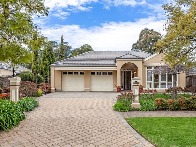
2/12 Hazelwood Avenue
Sold Sept 2026 · Contact agent
3 bedrooms 2 bathrooms 2 car spaces 526 m² land

20 Seaforth Avenue
For sale since Sept 2026 · $2,750,000 - $3,000,000
5 bedrooms 2 bathrooms 4 car spaces 801 m² land

1/15 Howard Terrace
For sale since Sept 2026 · $750,000-$800,000
2 bedrooms 1 bathroom 1 car space

475 Glynburn Road
Sold Aug 2026 · Contact agent
5 bedrooms 3 bathrooms 4 car spaces 1,541 m² land

7/11 Hawthorn Crescent
Sold July 2026 · Contact agent
1 bedroom 1 bathroom 1 car space

2/6 Seaforth Avenue
Sold June 2026 · $776,000
2 bedrooms 1 bathroom 1 car space

1/472 Greenhill Road
Sold May 2026 · $928,000
3 bedrooms 1 bathroom 1 car space

1 Dryden Avenue
Sold May 2026 · $1,550,000
4 bedrooms 2 bathrooms 2 car spaces 742 m² land
2/12 Hazelwood Avenue
Sold Sept 2026 · Contact agent
3 bedrooms 2 bathrooms 2 car spaces 526 m² land
475 Glynburn Road
Sold Aug 2026 · Contact agent
5 bedrooms 3 bathrooms 4 car spaces 1,541 m² land
7/11 Hawthorn Crescent
Sold July 2026 · Contact agent
1 bedroom 1 bathroom 1 car space
2/6 Seaforth Avenue
Sold June 2026 · $776,000
2 bedrooms 1 bathroom 1 car space
1/472 Greenhill Road
Sold May 2026 · $928,000
3 bedrooms 1 bathroom 1 car space
1 Dryden Avenue
Sold May 2026 · $1,550,000
4 bedrooms 2 bathrooms 2 car spaces 742 m² land

505A Glynburn Road
Sold Mar 2026 · Contact agent
4 bedrooms 2 bathrooms 2 car spaces 402 m² land

31 Lerwick Avenue
Sold Jan 2026 · Contact agent
3 bedrooms 1 bathroom 1 car space
Local agents in Hazelwood Park


Julia Kirreh
Sales Partner Turner Real Estate
Last 12 months
- Properties sold
- 11
- Median sold price
- $1.18m
- Median days on market
- 23
Last 12 months
- Properties sold
- 114
- Median sold price
- $1.38m
- Median days on market
- 15
Last 12 months
- Properties sold
- 66
- Median sold price
- $1.29m
- Median days on market
- 16


Agencies that specialise in Hazelwood Park
Streets in Hazelwood Park
- Burns Avenue13 properties
- Byron Avenue3 properties
- Collingwood Avenue37 properties
- Cooper Place45 properties
- Davenport Terrace31 properties
- Devereux Road41 properties
- Doonoon Avenue13 properties
- Dryden Avenue22 properties
- Glynburn Road115 properties
- Greenhill Road107 properties
- Hawthorn Crescent17 properties
- Hazelwood Avenue59 properties
- Howard Terrace37 properties
- Kintore Avenue7 properties
- Kirkdale Avenue15 properties
- Knightsbridge Road35 properties
- Lancelot Avenue37 properties
- Lerwick Avenue38 properties
- Linden Avenue94 properties
- Maud Street10 properties
- Moore Avenue15 properties
- Olive Grove16 properties
- Rothesay Avenue40 properties
- Ruskin Place6 properties
- Russell Avenue52 properties
- Seaforth Avenue50 properties
- Seaton Avenue22 properties
- Sidney Place2 properties
- Strathspey Avenue41 properties
- The Parkway4 properties
- Wood Grove10 properties
Neighbouring suburbs
Addresses and streets incorporate or were developed using G-NAF © Geoscape Australia, licensed by the Commonwealth of Australia under the Open Geo-coded National Address File (G-NAF) End User Licence Agreement.
Population and housing figures are drawn from the Australian Bureau of Statistics, Census of Population and Housing 2021, licensed under Creative Commons Attribution 4.0 International.
Area summaries are generated from the national address file and ABS Census data, and checked against those figures before publication.