
Suburb profile
Hammond Park WA 6164
Hammond Park is located in the Perth South West region of Western Australia, postcode 6164. It has 4,214 properties across 169 streets, almost all houses. Explore every street in Hammond Park, its property history, homes for sale and rent, who lives there, and the local agents.
About Hammond Park
Hammond Park, WA 6164, sits in the Perth South West region and neighbours Atwell, Success, Aubin Grove and Beeliar. Its 169 streets hold 4,214 properties, 3,854 of them houses and 360 units.
Census figures are for Success - Hammond Park, an area that covers part of the suburb. It had 17,454 residents, a median age of 33 and an average household of 2.8 people. Median household income was $2,273 a week, the median mortgage repayment $1,993 a month and the median rent $400 a week. Of 6,014 dwellings, 4,867 were separate houses, 707 semi-detached and 436 flats; 863 were owned outright, 3,368 owned with a mortgage and 1,642 rented.
Updated October 2026
Who lives in Hammond Park
- 17,454Peoplelive in the area
- 33Median ageyears
- $2,273Median household incomea week
- $400Median renta week
Homes by type
- Houses4,867
- Townhouses and semis707
- Flats and apartments436
Household
- Median mortgage repayment$1,993a month
- Household size2.8people on average
How homes are held
For sale and rent in Hammond Park

 Damyn Strang

Under Offer
Lot 962, Gorringe Street, Hammond Park WA 6164

 Ash Swarts

UNDER OFFER BY TEAM ASH!
70 Irvine Parade, Hammond Park WA
 Damyn Strang
Under Offer
Lot 963, Gorringe Street, Hammond Park WA 6164
Properties in Hammond Park
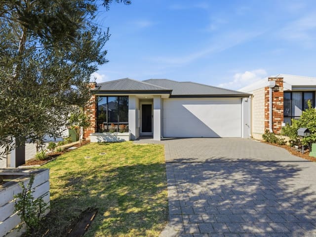
8 Jennings Street
Sold Sept 2026 · $855,000
4 bedrooms 2 bathrooms 2 car spaces 300 m² land

70 Irvine Parade
For sale since Sept 2026 · UNDER OFFER BY TEAM ASH!
2 bedrooms 2 bathrooms 2 car spaces 180 m² land

11 Jennings Street
Sold Sept 2026 · $935,000
4 bedrooms 2 bathrooms 2 car spaces 372 m² land

15 Desiree Street
Sold May 2026 · $975,000
4 bedrooms 2 bathrooms 2 car spaces 370 m² land

6 Lanciano Road
For sale since May 2026 · OFFERS INVITED !!!!!
375 m² land

12 Ronan Lane
Leased Jan 2026 · Contact agent
3 bedrooms 2 bathrooms 2 car spaces

23 Fragrant Street
Sold Dec 2025 · $875,000
3 bedrooms 2 bathrooms 2 car spaces 290 m² land

43 Whadjuk Drive
Sold July 2025 · $900,888
4 bedrooms 2 bathrooms 2 car spaces 375 m² land
8 Jennings Street
Sold Sept 2026 · $855,000
4 bedrooms 2 bathrooms 2 car spaces 300 m² land
11 Jennings Street
Sold Sept 2026 · $935,000
4 bedrooms 2 bathrooms 2 car spaces 372 m² land
15 Desiree Street
Sold May 2026 · $975,000
4 bedrooms 2 bathrooms 2 car spaces 370 m² land
23 Fragrant Street
Sold Dec 2025 · $875,000
3 bedrooms 2 bathrooms 2 car spaces 290 m² land
43 Whadjuk Drive
Sold July 2025 · $900,888
4 bedrooms 2 bathrooms 2 car spaces 375 m² land

3 Dorsal Bend
Sold Nov 2014 · $525,000
3 bedrooms 2 bathrooms 2 car spaces
Schools in Hammond Park
Hammond Park Catholic Primary School
CatholicPrimary
Hammond Park Primary School
GovernmentPrimary
Jilbup Primary School
GovernmentPrimary
Hammond Park Secondary College
GovernmentSecondary
Local agents in Hammond Park


Sam Hadden
Real Estate Sales & Strategy Specialist CY Property
Last 12 months
- Properties sold
- 15
- Median sold price
- $870k
- Median days on market
- 40

Michael Mort
Partner / Licenced Agent / Sales Team Manager CY Property
Last 12 months
- Properties sold
- 28
- Median sold price
- $900k
- Median days on market
- 50
Damyn Strang
Director & Head of Land Sales Abel Property Sales
Last 12 months
- Properties sold
- 558
- Median sold price
- $407k
- Median days on market
- 15
Agencies that specialise in Hammond Park
All 5 agencies in Hammond Park
Streets in Hammond Park
A
B
- Baler Court149 properties
- Barcoo Bend24 properties
- Barfield Road282 properties
- Bari Road21 properties
- Barwon Turn29 properties
- Baumea Turn38 properties
- Baxteri Way12 properties
- Beal Lane6 properties
- Bellingham Road39 properties
- Bischoff Road12 properties
- Blackstock Street15 properties
- Bonsai Lane7 properties
- Boota Way7 properties
- Bosworth Road3 properties
- Botany Parade33 properties
- Botrys Court8 properties
- Burdekin Vista20 properties
C
- Calabria Street22 properties
- Calypso Drive47 properties
- Campana Rise19 properties
- Canary Drive59 properties
- Canopus Loop24 properties
- Capello Lane14 properties
- Caridean Way19 properties
- Caro Way6 properties
- Caruso Lane5 properties
- Cembra Lane4 properties
- Chianti Way13 properties
- Chittick Road18 properties
- Condamine Approach9 properties
- Cooli Street42 properties
- Corbitt Lane6 properties
- Corsia Crescent41 properties
- Corymbia Way16 properties
- Costata Gate12 properties
- Cousins Street43 properties
- Criddle Way15 properties
D
E
F
G
H
I
J
L
M
- Macquarie Boulevard57 properties
- Maddalena Street17 properties
- Marginata Street16 properties
- Marquis Street21 properties
- Mcintosh Street14 properties
- Mcphee Road35 properties
- Melbourne Loop34 properties
- Menzie Road76 properties
- Milan Court4 properties
- Minigwal Loop76 properties
- Mirbelia Street8 properties
- Mitta Street29 properties
- Mohan Loop36 properties
- Moonah Way22 properties
- Murrumbidgee Drive45 properties
N
O
P
R
S
- Salmon Lane6 properties
- Sandleford Way18 properties
- Sardinia Place22 properties
- Scolaro Road18 properties
- Secretan Way5 properties
- Serenity Parkway28 properties
- Serventy Crescent32 properties
- Sessilis Lane9 properties
- Snowden Street23 properties
- Snowy Rise8 properties
- Sollya Lane2 properties
- Spinifex Road34 properties
- Spratley Street2 properties
- Staaten Street11 properties
- Sugargum Approach8 properties
T
U
V
W
Y
Neighbouring suburbs
Addresses and streets incorporate or were developed using G-NAF © Geoscape Australia, licensed by the Commonwealth of Australia under the Open Geo-coded National Address File (G-NAF) End User Licence Agreement.
Population and housing figures are drawn from the Australian Bureau of Statistics, Census of Population and Housing 2021, licensed under Creative Commons Attribution 4.0 International.
School details © Australian Curriculum, Assessment and Reporting Authority (ACARA), from the Australian Schools List, licensed under Creative Commons Attribution 4.0 International and modified. ACARA does not endorse Listd.
Area summaries are generated from the national address file and ABS Census data, and checked against those figures before publication.