
Suburb profile
Craigie WA 6025
Craigie is located in the Perth North West region of Western Australia, postcode 6025. It has 3,249 properties across 113 streets, almost all houses. Explore every street in Craigie, its property history, homes for sale and rent, who lives there, and the local agents.
About Craigie
Craigie, WA 6025, sits in the Perth North West region and neighbours Kingsley, Beldon, Edgewater and Hillarys. Its 113 streets hold 3,249 properties, 3,150 of them houses and 99 units.
Census figures are for the Craigie - Beldon area. It had 10,556 residents, a median age of 36 and an average household of 2.5 people. Median household income was $1,833 a week, the median mortgage repayment $1,800 a month and the median rent $370 a week. Of 4,169 dwellings, 3,786 were separate houses, 353 semi-detached and 33 flats; 1,104 were owned outright, 2,055 owned with a mortgage and 942 rented.
Updated October 2026
Who lives in Craigie
- 10,556Peoplelive in the area
- 36Median ageyears
- $1,833Median household incomea week
- $370Median renta week
Homes by type
- Houses3,786
- Townhouses and semis353
- Flats and apartments33
Household
- Median mortgage repayment$1,800a month
- Household size2.5people on average
How homes are held
For sale and rent in Craigie

 Julie Ormston

Under Offer
56 Revitalise Circuit, Craigie WA 6025

 Luke Martin
Under Offer
1 Adelaide Circle, Craigie WA 6025
Properties in Craigie

56 Revitalise Circuit
For sale since Oct 2026 · Under Offer
3 bedrooms 2 bathrooms 2 car spaces 332 m² land

1 Adelaide Circle
For sale since Sept 2026 · Under Offer
4 bedrooms 2 bathrooms 2 car spaces 810 m² land

17 Seaflower Crescent
Leased Aug 2026 · $765 per week
3 bedrooms 1 bathroom 1 car space
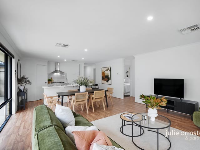
16 Vive Avenue
Sold July 2026 · $1,120,000
3 bedrooms 2 bathrooms 2 car spaces 386 m² land
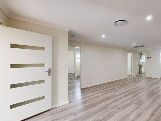
4A Cox Place
Sold July 2026 · $850,000
3 bedrooms 1 bathroom 2 car spaces 500 m² land

14 Tranmere Place
Sold July 2026 · $940,000
3 bedrooms 1 bathroom 1 car space 700 m² land

4A Mildura Road
Sold Apr 2026 · Contact agent
3 bedrooms 1 bathroom 1 car space 942 m² land

9A Ameer Way
Sold Feb 2026 · $1,035,000
3 bedrooms 2 bathrooms 398 m² land
16 Vive Avenue
Sold July 2026 · $1,120,000
3 bedrooms 2 bathrooms 2 car spaces 386 m² land
4A Cox Place
Sold July 2026 · $850,000
3 bedrooms 1 bathroom 2 car spaces 500 m² land
14 Tranmere Place
Sold July 2026 · $940,000
3 bedrooms 1 bathroom 1 car space 700 m² land
4A Mildura Road
Sold Apr 2026 · Contact agent
3 bedrooms 1 bathroom 1 car space 942 m² land
9A Ameer Way
Sold Feb 2026 · $1,035,000
3 bedrooms 2 bathrooms 398 m² land

47 Britannia Way
Sold Sept 2025 · $1,050,000
3 bedrooms 1 bathroom 1 car space 670 m² land

8 Mario Way
Sold June 2025 · $933,333
3 bedrooms 1 bathroom 2 car spaces 680 m² land

40A Allinga Crescent
Sold Jan 2025 · $370,000
299 m² land
Schools in Craigie
Craigie Heights Primary School
GovernmentPrimary
Whitford Catholic Primary School
CatholicPrimary
No secondary schools in Craigie.
Local agents in Craigie


Daniel Porcaro
Property Consultant Mark Hay Real Estate
Last 12 months
- Properties sold
- 26
- Median sold price
- $853k
- Median days on market
- 75


Carole Saville
Director/Licensee Carole Saville Inspiring Real Estate
Last 12 months
- Properties sold
- 37
- Median sold price
- $1.05m
- Median days on market
- 6
Luke Martin
Sales Partner Julie Ormston & Partners
Last 12 months
- Properties sold
- 39
- Median sold price
- $1.15m
- Median days on market
- 6
Agencies that specialise in Craigie

Streets in Craigie
A
- Acadia Gardens4 properties
- Addingham Court5 properties
- Adelaide Circle60 properties
- Albion Street16 properties
- Allambie Drive21 properties
- Allinga Crescent52 properties
- Ameer Way21 properties
- Amy Loop39 properties
- Arawa Place49 properties
- Argo Court6 properties
- Argus Close7 properties
- Ashwood Court14 properties
- Atwick Way42 properties
B
C
- Camberwarra Drive353 properties
- Cawarra Crescent22 properties
- Chadstone Road91 properties
- Charon Place7 properties
- Christina Court9 properties
- Cingalee Place18 properties
- Coral Street16 properties
- Cordova Court26 properties
- Corima Place18 properties
- Cox Place6 properties
- Coyle Road13 properties
- Craigie Drive80 properties
- Currajong Crescent78 properties
D
E
F
G
H
I
K
L
M
- Macedon Place69 properties
- Madana Place32 properties
- Malabar Crescent40 properties
- Mandalay Place48 properties
- Mandarin Court19 properties
- Mario Way38 properties
- Matilda Mews6 properties
- Mayflower Crescent62 properties
- Mayhill Place17 properties
- Mildura Road16 properties
- Montreal Street12 properties
- Morang Court8 properties
N
O
P
R
S
T
U
V
W
Z
Neighbouring suburbs
Addresses and streets incorporate or were developed using G-NAF © Geoscape Australia, licensed by the Commonwealth of Australia under the Open Geo-coded National Address File (G-NAF) End User Licence Agreement.
Population and housing figures are drawn from the Australian Bureau of Statistics, Census of Population and Housing 2021, licensed under Creative Commons Attribution 4.0 International.
School details © Australian Curriculum, Assessment and Reporting Authority (ACARA), from the Australian Schools List, licensed under Creative Commons Attribution 4.0 International and modified. ACARA does not endorse Listd.
Area summaries are generated from the national address file and ABS Census data, and checked against those figures before publication.