
Suburb profile
Claremont TAS 7011
Claremont is located in the Hobart region of Tasmania, postcode 7011. It has 4,932 properties across 115 streets. Explore every street in Claremont, its property history, homes for sale and rent, who lives there, and the local agents.
About Claremont
Claremont, TAS 7011, sits in the Hobart region and neighbours Austins Ferry, Berriedale, Chigwell and Granton. Its 115 streets hold 4,932 properties, 3,177 of them houses and 1,755 units.
At the 2021 Census Claremont (Tas.) had 8,397 residents, a median age of 38 and an average household of 2.3 people. Median household income was $1,241 a week, the median mortgage repayment $1,300 a month and the median rent $320 a week. Of 3,403 dwellings, 2,478 were separate houses, 102 semi-detached and 812 flats; 954 were owned outright, 1,086 owned with a mortgage and 1,188 rented.
Updated October 2026
Who lives in Claremont
- 8,397Peoplelive in the area
- 38Median ageyears
- $1,241Median household incomea week
- $320Median renta week
Homes by type
- Houses2,478
- Townhouses and semis102
- Flats and apartments812
Household
- Median mortgage repayment$1,300a month
- Household size2.3people on average
How homes are held
For sale and rent in Claremont
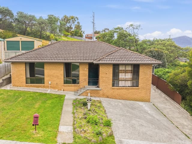
 Aaron Murray

$595,000 +
11 Battersby Drive, Claremont TAS 7011
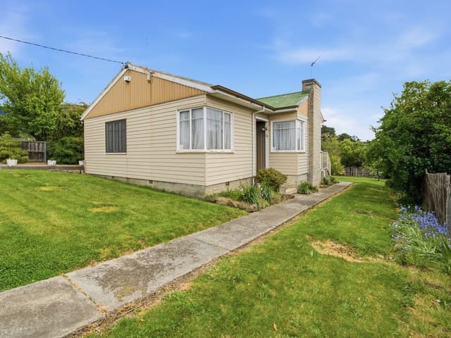
 Damien Hollingsworth
Offers over $499,000
58 Box Hill Road, Claremont TAS 7011
 Aaron Murray
$295,000 +
9 Leighland Road, Claremont TAS 7011
Properties in Claremont

11 Battersby Drive
For sale since Oct 2026 · $595,000 +
3 bedrooms 2 bathrooms 4 car spaces 605 m² land

58 Box Hill Road
For sale since Oct 2026 · Offers over $499,000
3 bedrooms 1 bathroom 3 car spaces 686 m² land

9 Leighland Road
For sale since Oct 2026 · $295,000 +
2 bedrooms 1 bathroom 2 car spaces 1,381.1 m² land

5/88A Hilton Road
For sale since Sept 2026 · Offers Over $419,000
2 bedrooms 1 bathroom 1 car space 172 m² land

7 Colston Street
Sold Sept 2026 · $681,500
3 bedrooms 1 bathroom 6 car spaces 640 m² land

41 Adelphi Road
For sale since Sept 2026 · $649,000 +
3 bedrooms 1 bathroom 2 car spaces 695 m² land

28 Centenary Crescent
For sale since Aug 2026 · Offers over $575,000
3 bedrooms 1 bathroom 8 car spaces 775 m² land
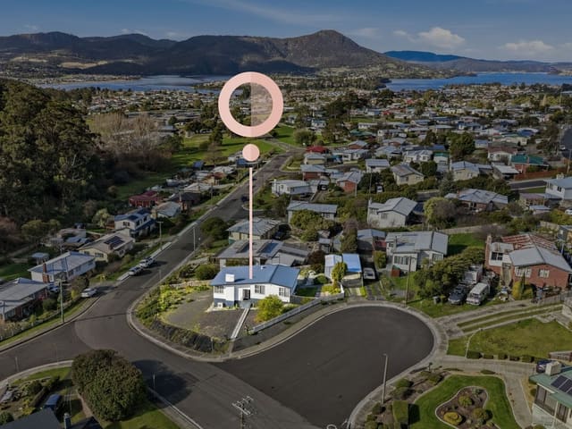
46 Spring Street
Sold Aug 2026 · $675,000
3 bedrooms 1 bathroom 4 car spaces 837 m² land
7 Colston Street
Sold Sept 2026 · $681,500
3 bedrooms 1 bathroom 6 car spaces 640 m² land
46 Spring Street
Sold Aug 2026 · $675,000
3 bedrooms 1 bathroom 4 car spaces 837 m² land
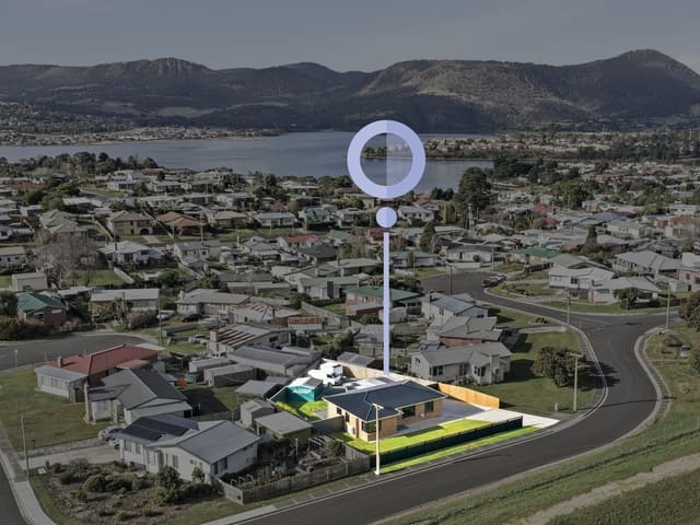
20 Malabar Road
Sold Aug 2026 · $735,000
3 bedrooms 1 bathroom 2 car spaces 688 m² land
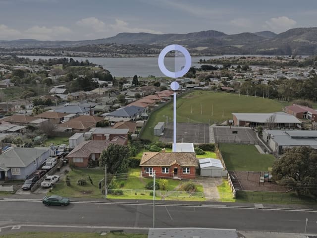
33 Wyndham Road
Sold Aug 2026 · $635,000
4 bedrooms 1 bathroom 3 car spaces 976 m² land

20 Mason Street
Sold Aug 2026 · $680,000
3 bedrooms 1 bathroom 2 car spaces 658 m² land

51 Cleburne Street
Sold Aug 2026 · $670,000
3 bedrooms 1 bathroom 2 car spaces 637 m² land

20 Leighland Road
Sold Aug 2026 · $684,000
3 bedrooms 1 bathroom 4 car spaces 683 m² land

9 Mcgill Rise
Sold Aug 2026 · $580,000
3 bedrooms 1 bathroom 2 car spaces 353 m² land
Schools in Claremont
Austins Ferry Primary School
GovernmentPrimary
Holy Rosary Catholic School
CatholicPrimary
OneSchool Global - Hobart Campus
IndependentPrimary and secondary
Windermere Primary School
GovernmentPrimary
Claremont College
GovernmentSecondary
OneSchool Global - Hobart Campus
IndependentPrimary and secondary
Local agents in Claremont

Ladence Tandukar
Personal Assistant to Aaron Murray 4one4 Property Co.
Last 12 months
- Properties sold
- 147
- Median sold price
- $650k
- Median days on market
- 28
Aaron Murray
Sales Agent 4one4 Property Co.
Last 12 months
- Properties sold
- 153
- Median sold price
- $650k
- Median days on market
- 28

Marilyn Rooney
Sales Consultant 4one4 Property Co.
Last 12 months
- Properties sold
- 25
- Median sold price
- $640k
- Median days on market
- 20
Agencies that specialise in Claremont
Streets in Claremont
A
B
- Ball Court18 properties
- Bateman Court25 properties
- Battersby Drive40 properties
- Baxter Street15 properties
- Belgrave Street34 properties
- Bilton Street68 properties
- Bilton Walk38 properties
- Birnam Street6 properties
- Blackwell Court9 properties
- Bluegum Court21 properties
- Bonwick Court13 properties
- Boston Court19 properties
- Bournville Crescent119 properties
- Box Hill Road171 properties
- Boyd Court21 properties
- Bradfield Street27 properties
- Branscombe Road218 properties
- Bristol Road36 properties
- Brodie Street18 properties
C
- Cadbury Road403 properties
- Cammeray Road38 properties
- Canberra Road49 properties
- Carnegie Street71 properties
- Centenary Crescent55 properties
- Chatterton Court50 properties
- Chippendale Street94 properties
- Claremont Link Road3 properties
- Cleburne Street52 properties
- Cohen Court8 properties
- Colston Street34 properties
- Cowper Road22 properties
- Cullen Street21 properties
- Curlew Parade38 properties
D
E
F
G
H
I
J
K
L
M
- Macrobertsons Terrace27 properties
- Mahoney Drive54 properties
- Main Road223 properties
- Malabar Road31 properties
- Marne Court17 properties
- Mason Street61 properties
- Matteo Circle34 properties
- Mcgill Rise33 properties
- Mitcham Road16 properties
- Molloy Court13 properties
- Mongana Street13 properties
- Moreton Crescent13 properties
- Mount Faulkner Road2 properties
N
O
P
Q
R
S
T
U
W
Neighbouring suburbs
Addresses and streets incorporate or were developed using G-NAF © Geoscape Australia, licensed by the Commonwealth of Australia under the Open Geo-coded National Address File (G-NAF) End User Licence Agreement.
Population and housing figures are drawn from the Australian Bureau of Statistics, Census of Population and Housing 2021, licensed under Creative Commons Attribution 4.0 International.
School details © Australian Curriculum, Assessment and Reporting Authority (ACARA), from the Australian Schools List, licensed under Creative Commons Attribution 4.0 International and modified. ACARA does not endorse Listd.
Area summaries are generated from the national address file and ABS Census data, and checked against those figures before publication.