
Suburb profile
City ACT 2601
City is located in the Canberra region of the Australian Capital Territory, postcode 2601. It has 6,388 properties across 42 streets, mostly units. Explore every street in City, its property history, homes for sale and rent, who lives there, and the local agents.
About City
City, ACT 2601, is in the Canberra region and neighbours Turner, Acton, Braddon and Parkes. Its 42 streets hold 6,388 properties, 792 of them houses and 5,596 units.
Census figures are for the statistical area of Civic. At the 2021 Census Civic had 4,835 residents, a median age of 27 and an average household of 1.7 people. Median household income was $2,232 a week, the median mortgage repayment $1,950 a month and the median rent $550 a week. Of 1,796 dwellings, 1,788 were flats; 277 were owned outright, 375 owned with a mortgage and 1,107 rented.
Updated October 2026
Who lives in City
- 4,835Peoplelive in the area
- 27Median ageyears
- $2,232Median household incomea week
- $550Median renta week
Homes by type
- Flats and apartments1,788
Household
- Median mortgage repayment$1,950a month
- Household size1.7people on average
How homes are held
For sale and rent in City

 Karolyn Buckley

$580 per week
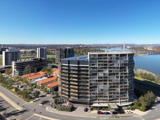
1304/25 Edinburgh Avenue, City ACT 2601
Available Sat, 19 Dec
 Karolyn Buckley
$600 per week
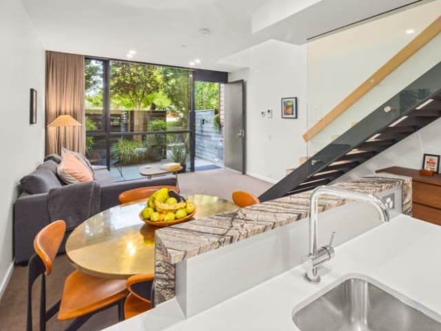
319/25 Edinburgh Avenue, City ACT 2601
Available Sat, 7 Nov
 Karolyn Buckley
$685 per week
G12/19 Marcus Clarke Street, City ACT 2601
Available now
Properties in City

1103/25 Edinburgh Avenue
Leased Oct 2026 · $520 per week
1 bedroom 1 bathroom 1 car space

1304/25 Edinburgh Avenue
For rent since Oct 2026 · $580 per week
1 bedroom 1 bathroom 1 car space

319/25 Edinburgh Avenue
For rent since Oct 2026 · $600 per week
1 bedroom 1 bathroom 1 car space

1505/25 Edinburgh Avenue
Leased Oct 2026 · $580 per week
1 bedroom 1 bathroom 1 car space

1515/25 Edinburgh Avenue
Leased Sept 2026 · $750 per week
2 bedrooms 2 bathrooms 2 car spaces

901/25 Edinburgh Avenue
Leased Sept 2026 · $580 per week
1 bedroom 1 bathroom 1 car space

G7/19 Marcus Clarke Street
Leased Sept 2026 · $695 per week
1 bedroom 1 bathroom 1 car space

6/1 The Mews
Sold Sept 2026 · $510,000
2 bedrooms 1 bathroom 1 car space
6/1 The Mews
Sold Sept 2026 · $510,000
2 bedrooms 1 bathroom 1 car space

912/25 Edinburgh Avenue
Sold Aug 2026 · $700,000
2 bedrooms 2 bathrooms 2 car spaces

43/2 Edinburgh Avenue
Sold July 2026 · $418,500
1 bedroom 1 bathroom 1 car space

67/15 Coranderrk Street
Sold Apr 2026 · $405,000
1 bedroom 1 bathroom 1 car space

115/20 Allara Street
Sold Mar 2026 · $550,000
2 bedrooms 1 bathroom 1 car space

44/3 London Circuit
Sold Oct 2025 · $425,000
1 bedroom 1 bathroom 1 car space

28/66 Allara Street
Sold June 2023 · $497,000
1 bedroom 1 bathroom 1 car space

70/3 London Circuit
Sold Jan 2019 · Contact agent
1 bedroom 1 bathroom 1 car space
Local agents in City


Mark Larmer And Aaron Lewis
Licensed Agent, Auctioneer & Senior Sales Consultant Suburbia Real Estate
Last 12 months
- Properties sold
- 88
- Median sold price
- $750k
- Median days on market
- 28
Karolyn Buckley
Senior Property Manager REMAX Capital - Kingston
Agencies that specialise in City
Streets in City
A
B
C
D
E
F
G
H
K
L
M
N
P
R
S
T
U
W
Neighbouring suburbs
Addresses and streets incorporate or were developed using G-NAF © Geoscape Australia, licensed by the Commonwealth of Australia under the Open Geo-coded National Address File (G-NAF) End User Licence Agreement.
Population and housing figures are drawn from the Australian Bureau of Statistics, Census of Population and Housing 2021, licensed under Creative Commons Attribution 4.0 International.
Area summaries are generated from the national address file and ABS Census data, and checked against those figures before publication.