
Suburb profile
Christie Downs SA 5164
Christie Downs is located in the Adelaide South region of South Australia, postcode 5164. It has 2,867 properties across 117 streets, mostly houses. Explore every street in Christie Downs, its property history, homes for sale and rent, who lives there, and the local agents.
About Christie Downs
Christie Downs, SA 5164, sits in the Adelaide South region and neighbours Hackham West, Lonsdale, Morphett Vale and Noarlunga Centre. Its 117 streets hold 2,867 properties, 2,265 of them houses and 602 units.
At the Census Christie Downs had 9,475 residents, a median age of 40 and an average household of 2.2 people. Median household income was $995 a week, the median mortgage repayment $1,250 a month and the median rent $250 a week. Of 3,885 dwellings, 3,148 were separate houses, 612 semi-detached and 121 flats; 845 were owned outright, 1,286 owned with a mortgage and 1,570 rented.
Updated October 2026
Who lives in Christie Downs
- 9,475Peoplelive in the area
- 40Median ageyears
- $995Median household incomea week
- $250Median renta week
Homes by type
- Houses3,148
- Townhouses and semis612
- Flats and apartments121
Household
- Median mortgage repayment$1,250a month
- Household size2.2people on average
How homes are held
For sale and rent in Christie Downs

 Austin Green

$630,000
Proposed Allotments 91 Elizabeth Road, Christie Downs SA 5164

 Sam Bennett
$800,000 each
1 & 2/60 Christina Road, Christie Downs SA 5164

Properties in Christie Downs

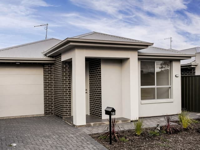
16 Hyacinth Crescent
For rent since Oct 2026 · $570 per week
3 bedrooms 1 bathroom 2 car spaces

12 Helen Street
Sold Aug 2026 · $760,000
3 bedrooms 1 bathroom 2 car spaces 705 m² land

16 Edmund Street
Sold Aug 2026 · $725,000
3 bedrooms 1 bathroom 1 car space 652 m² land

5 Tenterton Road
Sold July 2026 · $788,000
3 bedrooms 1 bathroom 4 car spaces 715 m² land

20 Blaise Street
Sold July 2026 · Contact agent
3 bedrooms 1 bathroom 1 car space 220 m² land

15 Adrian Street
Sold July 2026 · Contact agent
3 bedrooms 1 bathroom 4 car spaces 664 m² land

16 Marilyn Avenue
Sold July 2026 · $760,000
3 bedrooms 1 bathroom 2 car spaces 658 m² land

91 Elizabeth Road
For sale since June 2026 · $630,000
3 bedrooms 1 bathroom 1 car space 815 m² land
12 Helen Street
Sold Aug 2026 · $760,000
3 bedrooms 1 bathroom 2 car spaces 705 m² land
16 Edmund Street
Sold Aug 2026 · $725,000
3 bedrooms 1 bathroom 1 car space 652 m² land
5 Tenterton Road
Sold July 2026 · $788,000
3 bedrooms 1 bathroom 4 car spaces 715 m² land
20 Blaise Street
Sold July 2026 · Contact agent
3 bedrooms 1 bathroom 1 car space 220 m² land
15 Adrian Street
Sold July 2026 · Contact agent
3 bedrooms 1 bathroom 4 car spaces 664 m² land
16 Marilyn Avenue
Sold July 2026 · $760,000
3 bedrooms 1 bathroom 2 car spaces 658 m² land

63 Chamberlain Drive
Sold June 2026 · Contact agent
3 bedrooms 1 bathroom 2 car spaces 464 m² land

43 Morton Road
Sold June 2026 · $750,000
3 bedrooms 2 bathrooms 2 car spaces 342 m² land
Schools in Christie Downs
Christie Downs Primary School
GovernmentPrimary
Lonsdale Heights Primary School
GovernmentPrimary
Cardijn College - Marcellin Campus
CatholicSecondary
Christies Beach High School
GovernmentSecondary
FAME - Flexible Accredited Meaningful Engagement
CatholicSpecial
Local agents in Christie Downs
Last 12 months
- Properties sold
- 122
- Median sold price
- $880k
- Median days on market
- 9
Last 12 months
- Properties sold
- 100
- Median sold price
- $900k
- Median days on market
- 9


Nathan Clegg
Property Consultant Gary J Smith Real Estate
Last 12 months
- Properties sold
- 42
- Median sold price
- $905k
- Median days on market
- 14

Agencies that specialise in Christie Downs
All 5 agencies in Christie Downs
Streets in Christie Downs
A
- Adrian Street41 properties
- Agnes Street8 properties
- Alban Street10 properties
- Alexander Crescent24 properties
- Alexis Street11 properties
- Amadeus Crescent23 properties
- Amberleigh Close34 properties
- Andrew Street17 properties
- Ansbert Street48 properties
- Anselm Street34 properties
- Antony Street12 properties
- Astrid Street8 properties
B
- Bain Street6 properties
- Barbara Street13 properties
- Barnabas Crescent45 properties
- Basil Street13 properties
- Beach Road8 properties
- Bede Street6 properties
- Beresford Avenue24 properties
- Blaise Street23 properties
- Blyth Street1 property
- Bogart Court5 properties
- Bonnie Court10 properties
- Brendan Street35 properties
- Brigid Street30 properties
- Bruno Court9 properties
C
- Cecilia Court10 properties
- Cecilia Road25 properties
- Chad Street6 properties
- Chamberlain Drive48 properties
- Charles Street22 properties
- Christina Road31 properties
- Christopher Road51 properties
- Claudia Street16 properties
- Clyde Court8 properties
- Coe Court54 properties
- Colman Street10 properties
- Columba Street5 properties
- Copernicus Road54 properties
- Cricket Ground Court12 properties
D
E
F
G
H
I
J
K
L
M
N
O
P
Q
R
S
T
V
W
Neighbouring suburbs
Addresses and streets incorporate or were developed using G-NAF © Geoscape Australia, licensed by the Commonwealth of Australia under the Open Geo-coded National Address File (G-NAF) End User Licence Agreement.
Population and housing figures are drawn from the Australian Bureau of Statistics, Census of Population and Housing 2021, licensed under Creative Commons Attribution 4.0 International.
School details © Australian Curriculum, Assessment and Reporting Authority (ACARA), from the Australian Schools List, licensed under Creative Commons Attribution 4.0 International and modified. ACARA does not endorse Listd.
Area summaries are generated from the national address file and ABS Census data, and checked against those figures before publication.