
Suburb profile
Chatswood NSW 2067
Chatswood is located in the North Shore and Hornsby region of New South Wales, postcode 2067. It has 18,275 properties across 155 streets, mostly units. Explore every street in Chatswood, its property history, homes for sale and rent, who lives there, and the local agents.
About Chatswood
Chatswood, NSW 2067, sits in the North Shore and Hornsby region and neighbours Artarmon, Castle Cove, Lane Cove North and Middle Cove. Its 155 streets hold 18,275 properties, 13,524 of them units and 4,751 houses.
Census figures are for Chatswood - East, which covers part of the suburb. The area had 19,601 residents, a median age of 37 and an average household of 2.5 people. Median household income was $2,123 a week, the median mortgage repayment $3,000 a month and the median rent $590 a week. Of 7,295 dwellings, 5,062 were flats, 1,882 separate houses, 337 semi-detached and 4 other. Tenure was 3,864 rented, 1,864 owned outright and 1,275 owned with a mortgage.
Updated October 2026
Who lives in Chatswood
- 19,601Peoplelive in the area
- 37Median ageyears
- $2,123Median household incomea week
- $590Median renta week
Homes by type
- Houses1,882
- Townhouses and semis337
- Flats and apartments5,062
- Other4
Household
- Median mortgage repayment$3,000a month
- Household size2.5people on average
How homes are held
For sale and rent in Chatswood

 Matthew Bourn

Contact Agent
6/832 Pacific Highway, Chatswood NSW 2067
Inspect tomorrow 2:30pm

 Ivan Jun Zhang
By Negotiation
2003/11 Railway Street, Chatswood NSW 2067
Inspect tomorrow 1:00pm

 John Priddy

From $395,000
244 Mowbray Road, Chatswood NSW 2067

 Jenny Chu
$880 Per Week
1305/9 Railway Street, Chatswood NSW 2067
Available now

$870 Per Week
10 Brown Street, Chatswood NSW 2067
Available now
 Jenny Chu
$880 Per Week
1307/7 Railway Street, Chatswood NSW 2067
Available now
Properties in Chatswood

6/832 Pacific Highway
For sale since Oct 2026 · Contact agent
2 bedrooms 1 bathroom 0 m² land

315/2A Help Street
Leased Oct 2026 · Contact agent
1 bedroom 1 bathroom 1 car space

2003/11 Railway Street
For sale since Oct 2026 · By Negotiation
2 bedrooms 2 bathrooms 1 car space

15/14 Brown Street
Leased Oct 2026 · $700 per week
1 bedroom 1 bathroom 1 car space 0 m² land

3/215-221 Victoria Avenue
Leased Sept 2026 · $850 per week
1 bedroom 1 bathroom 1 car space 0 m² land

1305/9 Railway Street
For rent since Sept 2026 · $880 per week
1 bedroom 1 bathroom 1 car space

19 Macquarie Street
Leased Sept 2026 · $1,160 per week
2 bedrooms 2 bathrooms 1 car space 276 m² land

10 Brown Street
For rent since Sept 2026 · $870 per week
1 bedroom 1 bathroom 1 car space

519/28 Anderson Street
Sold Sept 2026 · Contact agent
1 bedroom 1 bathroom 1 car space 89 m² land

22 Ferndale Street
Sold May 2026 · Contact agent
4 bedrooms 2 bathrooms 2 car spaces 565 m² land

6/1 Goodchap Road
Sold May 2026 · $1,080,000
2 bedrooms 2 bathrooms 1 car space 0 m² land

10/755-759 Pacific Highway
Sold Feb 2026 · $1,075,888
2 bedrooms 2 bathrooms 1 car space
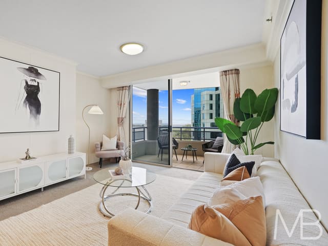
96/1 Katherine Street
Sold Nov 2025 · $830,000
1 bedroom 1 bathroom 1 car space 0 m² land

1808/9 Railway Street
Sold Sept 2025 · $2,250,000
2 bedrooms 2 bathrooms 1 car space

18 Park Avenue
Sold Sept 2025 · $3,860,000
3 bedrooms 1 bathroom 3 car spaces 638.6 m² land

3/16-22 Devonshire Street
Sold July 2025 · $1,140,000
2 bedrooms 1 bathroom 1 car space 0 m² land
Schools in Chatswood
Chatswood Public School
GovernmentPrimary
Our Lady of Dolours Catholic Primary School
CatholicPrimary
St Pius X College
IndependentPrimary and secondary
Chatswood High School
GovernmentSecondary
Mercy Catholic College
CatholicSecondary
St Pius X College
IndependentPrimary and secondary
Local agents in Chatswood

Last 12 months
- Properties sold
- 4
- Median sold price
- $1.05m
- Median days on market
- 33

Cooper Wang
Sales Manager REMAX Lead - Roseville
Last 12 months
- Properties sold
- 4
- Median sold price
- $1.05m
- Median days on market
- 33

Evan Kuixiao Wei
Director McConnell Bourn
Last 12 months
- Properties sold
- 9
- Median sold price
- $2.15m
- Median days on market
- 26

Agencies that specialise in Chatswood
All 10 agencies in Chatswood

Streets in Chatswood
A
B
- Baldry Street44 properties
- Beaconsfield Road246 properties
- Beauchamp Avenue11 properties
- Beresford Avenue29 properties
- Berkeley Court4 properties
- Bertram Street151 properties
- Blakesley Street34 properties
- Blue Gum Avenue3 properties
- Bowen Street84 properties
- Brown Street692 properties
- Bryson Street18 properties
C
- Cambridge Lane139 properties
- Carr Street20 properties
- Centennial Avenue180 properties
- Chapman Avenue16 properties
- Chatswood Avenue34 properties
- Church Street115 properties
- Clanwilliam Street26 properties
- Clarke Street11 properties
- Claude Street71 properties
- Colwell Crescent38 properties
- Cramer Crescent17 properties
- Crick Street47 properties
- Crispe Lane1 property
- Critchett Road13 properties
D
- Daisy Street27 properties
- Dalrymple Avenue57 properties
- Dardanelles Road12 properties
- Darling Street31 properties
- Davies Street16 properties
- Day Street69 properties
- De Villiers Avenue41 properties
- Dellwood Street13 properties
- Devonshire Street166 properties
- Douglas Avenue142 properties
- Dowel Street39 properties
- Dulwich Road19 properties
E
F
G
H
I
J
K
L
M
- Macartney Avenue19 properties
- Macquarie Street70 properties
- Malvern Avenue59 properties
- Mann Street8 properties
- Matheson Avenue15 properties
- Mccabe Place26 properties
- Mcintosh Street58 properties
- Mclean Avenue36 properties
- Mills Lane2 properties
- Milton Street10 properties
- Moola Parade26 properties
- Moriarty Road54 properties
- Mowbray Road168 properties
N
O
P
R
S
T
V
W
Neighbouring suburbs
Addresses and streets incorporate or were developed using G-NAF © Geoscape Australia, licensed by the Commonwealth of Australia under the Open Geo-coded National Address File (G-NAF) End User Licence Agreement.
Population and housing figures are drawn from the Australian Bureau of Statistics, Census of Population and Housing 2021, licensed under Creative Commons Attribution 4.0 International.
School details © Australian Curriculum, Assessment and Reporting Authority (ACARA), from the Australian Schools List, licensed under Creative Commons Attribution 4.0 International and modified. ACARA does not endorse Listd.
Area summaries are generated from the national address file and ABS Census data, and checked against those figures before publication.