
Suburb profile
Bonnet Bay NSW 2226
Bonnet Bay is located in the Sutherland Shire region of New South Wales, postcode 2226. It has 939 properties across 33 streets, almost all houses. Explore every street in Bonnet Bay, its property history, homes for sale and rent, who lives there, and the local agents.
About Bonnet Bay
Bonnet Bay, NSW 2226, sits in the Sutherland Shire and neighbours Como, Jannali, Woronora and Illawong. Its 33 streets hold 939 properties, 919 of them houses and 20 units.
Census figures are for Oyster Bay - Como - Jannali, an area with 22,063 residents, a median age of 40 and an average household of 2.9 people. Median household income was $2,745 a week, the median mortgage repayment $3,000 a month and the median rent $500 a week. Of 7,383 dwellings, 5,586 were separate houses, 1,150 semi-detached, 622 flats and 18 other; 2,788 were owned outright, 3,391 owned with a mortgage and 1,095 rented.
Updated October 2026
Who lives in Bonnet Bay
- 22,063Peoplelive in the area
- 40Median ageyears
- $2,745Median household incomea week
- $500Median renta week
Homes by type
- Houses5,586
- Townhouses and semis1,150
- Flats and apartments622
- Other18
Household
- Median mortgage repayment$3,000a month
- Household size2.9people on average
How homes are held
For sale and rent in Bonnet Bay

 Shane Flanagan

For Sale | $1,300,000 - $1,400,000
18 Lincoln Crescent, Bonnet Bay NSW
Inspect today 5:00pm

 John Basa

$3,850,000
29 Johnson Close, Bonnet Bay NSW 2226
Inspect Sat, 31 Oct 1:00pm
Properties in Bonnet Bay
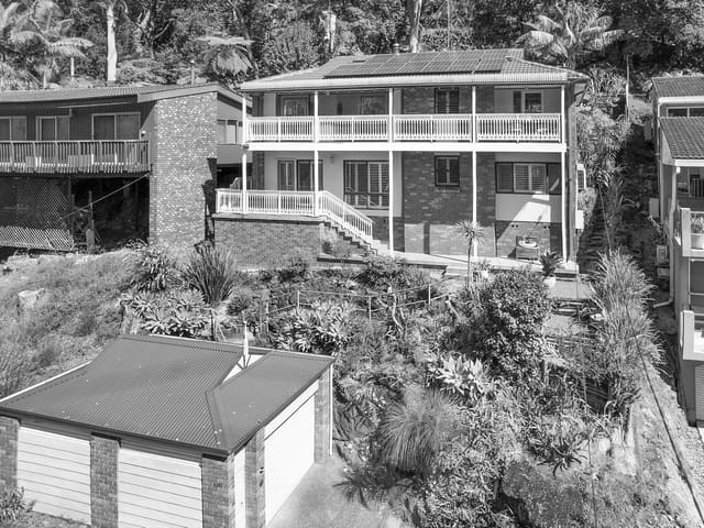
11 Hoover Place
Sold Oct 2026 · Contact agent
5 bedrooms 2 bathrooms 1 car space 683 m² land

18 Lincoln Crescent
For sale since Sept 2026 · For Sale | $1,300,000 - $1,400,000
3 bedrooms 1 bathroom 2 car spaces 910 m² land

146 Lower Washington Drive
Leased July 2026 · $990 per week
3 bedrooms 2 bathrooms 2 car spaces

20 Mckinley Avenue
Sold July 2026 · $1,800,000
5 bedrooms 2 bathrooms 2 car spaces 715 m² land

100 Washington Drive
Sold July 2026 · Contact agent
4 bedrooms 2 bathrooms 2 car spaces 575 m² land

1 Garfield Avenue
Sold Apr 2026 · Contact agent
4 bedrooms 2 bathrooms 4 car spaces 1,052 m² land

61 Washington Drive
Sold Mar 2026 · $1,810,000
3 bedrooms 3 bathrooms 2 car spaces 576 m² land

127 Lower Washington Drive
Sold Mar 2026 · Contact agent
4 bedrooms 3 bathrooms 2 car spaces
11 Hoover Place
Sold Oct 2026 · Contact agent
5 bedrooms 2 bathrooms 1 car space 683 m² land
20 Mckinley Avenue
Sold July 2026 · $1,800,000
5 bedrooms 2 bathrooms 2 car spaces 715 m² land
100 Washington Drive
Sold July 2026 · Contact agent
4 bedrooms 2 bathrooms 2 car spaces 575 m² land
1 Garfield Avenue
Sold Apr 2026 · Contact agent
4 bedrooms 2 bathrooms 4 car spaces 1,052 m² land
61 Washington Drive
Sold Mar 2026 · $1,810,000
3 bedrooms 3 bathrooms 2 car spaces 576 m² land
127 Lower Washington Drive
Sold Mar 2026 · Contact agent
4 bedrooms 3 bathrooms 2 car spaces

23 Eisenhower Place
Sold Feb 2026 · $1,760,000
4 bedrooms 2 bathrooms 2 car spaces 594 m² land

5 Wilson Place
Sold Nov 2025 · $2,200,000
6 bedrooms 3 bathrooms 2 car spaces 587.9 m² land
Schools in Bonnet Bay
Bonnet Bay Public School
GovernmentPrimary
No secondary schools in Bonnet Bay.
Local agents in Bonnet Bay

Jed Wood
Director Fox & Wood
Last 12 months
- Properties sold
- 75
- Median sold price
- $1.59m
- Median days on market
- 22

Danny Fox
Director Fox & Wood
Last 12 months
- Properties sold
- 78
- Median sold price
- $1.55m
- Median days on market
- 22

Last 12 months
- Properties sold
- 24
- Median sold price
- $1.3m
- Median days on market
- 28

Agencies that specialise in Bonnet Bay
Streets in Bonnet Bay
- Arthur Place11 properties
- Arthur Street15 properties
- Buchanan Avenue63 properties
- Cleveland Place29 properties
- Coolidge Crescent9 properties
- Eisenhower Place27 properties
- Fillmore Road17 properties
- Garfield Avenue38 properties
- Grant Place11 properties
- Harding Place16 properties
- Harrison Avenue37 properties
- Hayes Place6 properties
- Hoover Place9 properties
- Jefferson Crescent26 properties
- Johnson Close25 properties
- Kennedy Crescent30 properties
- Lincoln Crescent48 properties
- Lower Washington Drive44 properties
- Madison Place22 properties
- Mckinley Avenue19 properties
- Nixon Place13 properties
- Pierce Place8 properties
- Polk Place7 properties
- Roosevelt Place10 properties
- Taft Place20 properties
- Truman Avenue23 properties
- Truman Place8 properties
- Tudar Road46 properties
- Tyler Place5 properties
- Upper Washington Drive50 properties
- Van Buren Circuit38 properties
- Washington Drive198 properties
- Wilson Place11 properties
Neighbouring suburbs
Addresses and streets incorporate or were developed using G-NAF © Geoscape Australia, licensed by the Commonwealth of Australia under the Open Geo-coded National Address File (G-NAF) End User Licence Agreement.
Population and housing figures are drawn from the Australian Bureau of Statistics, Census of Population and Housing 2021, licensed under Creative Commons Attribution 4.0 International.
School details © Australian Curriculum, Assessment and Reporting Authority (ACARA), from the Australian Schools List, licensed under Creative Commons Attribution 4.0 International and modified. ACARA does not endorse Listd.
Area summaries are generated from the national address file and ABS Census data, and checked against those figures before publication.