
Suburb profile
Blakehurst NSW 2221
Blakehurst is located in the Inner South West region of New South Wales, postcode 2221. It has 3,119 properties across 70 streets, mostly houses. Explore every street in Blakehurst, its property history, homes for sale and rent, who lives there, and the local agents.
About Blakehurst
Blakehurst, NSW 2221, sits in the Inner South West region and neighbours Sylvania, Carlton, Connells Point and Kogarah Bay. Its 70 streets hold 3,119 properties, 2,242 of them houses and 877 units.
Census figures are for South Hurstville - Blakehurst, which had 25,259 residents, a median age of 38 and an average household of 2.9 people. Median household income was $2,097 a week, the median mortgage repayment $2,600 a month and the median rent $490 a week. Of 8,286 dwellings, 4,565 were separate houses, 927 semi-detached and 2,760 flats, with 17 other; 2,896 were owned outright, 2,673 owned with a mortgage and 2,454 rented.
Updated October 2026
Who lives in Blakehurst
- 25,259Peoplelive in the area
- 38Median ageyears
- $2,097Median household incomea week
- $490Median renta week
Homes by type
- Houses4,565
- Townhouses and semis927
- Flats and apartments2,760
- Other17
Household
- Median mortgage repayment$2,600a month
- Household size2.9people on average
How homes are held
Properties in Blakehurst
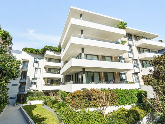
303/36 Bunyala Street
Leased Sept 2026 · $1,100 per week
2 bedrooms 2 bathrooms 2 car spaces
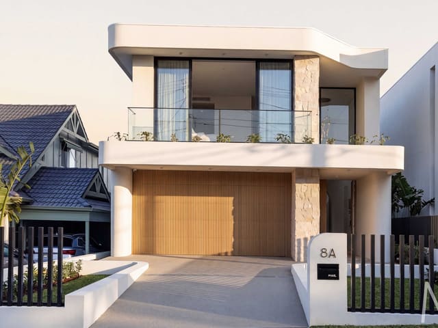
8A Como Street
Sold Aug 2026 · Contact agent
5 bedrooms 4 bathrooms 4 car spaces 405 m² land

15 Faye Avenue
Sold Oct 2025 · $2,005,000
4 bedrooms 2 bathrooms 2 car spaces 486.9 m² land

15 Cooleen Street
Sold Aug 2021 · $2,491,000
5 bedrooms 5 bathrooms 4 car spaces 762 m² land

25 Stuart Street
Leased · $2,200 per week
5 bedrooms 3 bathrooms 4 car spaces
Schools in Blakehurst
Bald Face Public School
GovernmentPrimary
Blakehurst Public School
GovernmentPrimary
Mater Dei Catholic Primary School
CatholicPrimary
Blakehurst High School
GovernmentSecondary
Local agents in Blakehurst


Evan Kuixiao Wei
Director McConnell Bourn
Last 12 months
- Properties sold
- 9
- Median sold price
- $2.15m
- Median days on market
- 26

Cathy Yuan Tian
Partner | Senior Sales Executive McConnell Bourn Sydney
Last 12 months
- Properties sold
- 41
- Median sold price
- $945k
- Median days on market
- 51
Agencies that specialise in Blakehurst

Streets in Blakehurst
A
B
C
D
E
F
G
H
J
K
L
M
N
O
P
R
S
T
V
W
Neighbouring suburbs
Addresses and streets incorporate or were developed using G-NAF © Geoscape Australia, licensed by the Commonwealth of Australia under the Open Geo-coded National Address File (G-NAF) End User Licence Agreement.
Population and housing figures are drawn from the Australian Bureau of Statistics, Census of Population and Housing 2021, licensed under Creative Commons Attribution 4.0 International.
School details © Australian Curriculum, Assessment and Reporting Authority (ACARA), from the Australian Schools List, licensed under Creative Commons Attribution 4.0 International and modified. ACARA does not endorse Listd.
Area summaries are generated from the national address file and ABS Census data, and checked against those figures before publication.