
Suburb profile
Bertram WA 6167
Bertram is located in the Perth South West region of Western Australia, postcode 6167. It has 2,282 properties across 108 streets, almost all houses. Explore every street in Bertram, its property history, homes for sale and rent, who lives there, and the local agents.
About Bertram
Bertram, WA 6167, sits in the Perth South West region and neighbours The Spectacles, Anketell, Casuarina and Parmelia. Its 108 streets hold 2,282 properties, 2,156 of them houses and 126 units.
Census figures are for Wellard (West) - Bertram, which had 17,953 residents, a median age of 31 and an average household of 3 people. Median household income was $2,068 a week, the median mortgage repayment $1,800 a month and the median rent $350 a week. Of 5,798 dwellings, 5,554 were separate houses, 125 semi-detached and 116 flats; 510 were owned outright, 3,552 owned with a mortgage and 1,627 rented.
Updated October 2026
Who lives in Bertram
- 17,953Peoplelive in the area
- 31Median ageyears
- $2,068Median household incomea week
- $350Median renta week
Homes by type
- Houses5,554
- Townhouses and semis125
- Flats and apartments116
Household
- Median mortgage repayment$1,800a month
- Household size3people on average
How homes are held
For sale and rent in Bertram

 Michael Coulson

Offers above $725,000
2 Budd Way, Bertram WA 6167
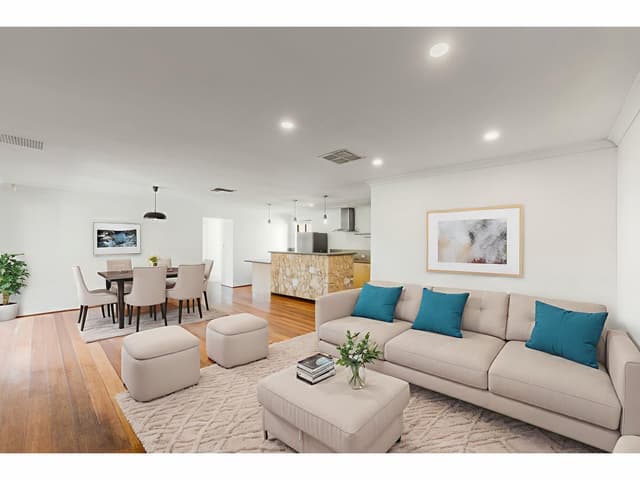
$680 per week
51 Araluen Crescent, Bertram WA 6167
Available Fri, 6 Nov
Properties in Bertram

51 Araluen Crescent
For rent since Oct 2026 · $680 per week
4 bedrooms 2 bathrooms 4 car spaces 600 m² land

2 Budd Way
For sale since Oct 2026 · Offers above $725,000
4 bedrooms 2 bathrooms 2 car spaces 453 m² land
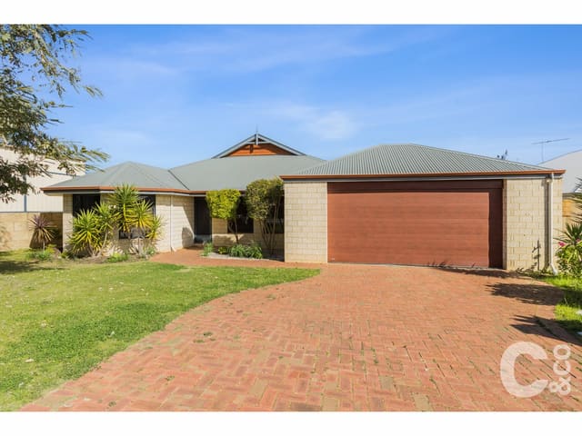
5 Mccallum Parkway
Sold Oct 2026 · $850,000
4 bedrooms 2 bathrooms 2 car spaces 559 m² land

11 Cattal Lane
Sold Sept 2026 · $550,000
2 bedrooms 1 bathroom 1 car space 133 m² land

3 Ludlow Way
Sold Aug 2026 · $615,000
3 bedrooms 2 bathrooms 2 car spaces 256 m² land

30 Silverline Bend
Leased May 2026 · $620 per week
3 bedrooms 2 bathrooms 4 car spaces 331 m² land

23 Whiteman Crescent
Leased May 2026 · $700 per week
4 bedrooms 2 bathrooms 2 car spaces 560 m² land

11 Mccallum Parkway
Leased Apr 2026 · $730 per week
4 bedrooms 2 bathrooms 2 car spaces 559 m² land
5 Mccallum Parkway
Sold Oct 2026 · $850,000
4 bedrooms 2 bathrooms 2 car spaces 559 m² land
11 Cattal Lane
Sold Sept 2026 · $550,000
2 bedrooms 1 bathroom 1 car space 133 m² land
3 Ludlow Way
Sold Aug 2026 · $615,000
3 bedrooms 2 bathrooms 2 car spaces 256 m² land

28 Minstrell Road
Sold Mar 2026 · $889,000
4 bedrooms 2 bathrooms 2 car spaces 560 m² land

4 Eliza Way
Sold Dec 2025 · $904,000
4 bedrooms 2 bathrooms 2 car spaces 652 m² land

12 Dewsbury Drive
Sold Aug 2025 · $750,000
4 bedrooms 2 bathrooms 2 car spaces 448 m² land

27 Antrim Way
Sold June 2025 · $650,000
3 bedrooms 2 bathrooms 2 car spaces 359 m² land

28 Burkett Terrace
Sold Feb 2025 · $653,000
4 bedrooms 2 bathrooms 2 car spaces 407 m² land
Schools in Bertram
Bertram Primary School
GovernmentPrimary
No secondary schools in Bertram.
Agencies that specialise in Bertram

Streets in Bertram
A
B
C
- Camballin Loop31 properties
- Camborne Approach10 properties
- Cape York Ramble24 properties
- Caroline Crescent22 properties
- Cattal Lane8 properties
- Centennial Avenue118 properties
- Champion Drive46 properties
- Charlton Way15 properties
- Cheltenham Loop56 properties
- Chieftain Street35 properties
- Chipperton Road24 properties
- Cleopatra Circuit9 properties
- Corrour Bend17 properties
D
E
G
H
J
K
L
M
- Mandora Street2 properties
- Mangart Road7 properties
- Maynard Way6 properties
- Mccallum Parkway14 properties
- Mckenzie Corner18 properties
- Mickle Way9 properties
- Millbrook Avenue109 properties
- Millom Way15 properties
- Minstrell Road41 properties
- Moombaki Avenue39 properties
- Moston Crescent36 properties
- Murphy Crescent16 properties
N
O
P
R
S
T
U
W
Y
Neighbouring suburbs
Addresses and streets incorporate or were developed using G-NAF © Geoscape Australia, licensed by the Commonwealth of Australia under the Open Geo-coded National Address File (G-NAF) End User Licence Agreement.
Population and housing figures are drawn from the Australian Bureau of Statistics, Census of Population and Housing 2021, licensed under Creative Commons Attribution 4.0 International.
School details © Australian Curriculum, Assessment and Reporting Authority (ACARA), from the Australian Schools List, licensed under Creative Commons Attribution 4.0 International and modified. ACARA does not endorse Listd.
Area summaries are generated from the national address file and ABS Census data, and checked against those figures before publication.