
Suburb profile
Telarah NSW 2320
Telarah is located in the Hunter Valley region of New South Wales, postcode 2320. It has 1,279 properties across 36 streets, mostly houses. Explore every street in Telarah, its property history, homes for sale and rent, who lives there, and the local agents.
About Telarah
Telarah, NSW 2320, sits in the Hunter Valley region and neighbours Gillieston Heights, Maitland, Rutherford and Farley. Its 36 streets hold 1,279 properties, 1,083 of them houses and 196 units.
Census figures are for the Rutherford (South) - Telarah area, which had 7,976 residents, a median age of 34 and an average household of 2.5 people. Median household income was $1,470 a week, the median mortgage repayment $1,647 a month and the median rent $330 a week. Of 3,012 dwellings, 2,674 were separate houses, 256 semi-detached and 78 flats; 760 were owned outright, 1,154 owned with a mortgage and 1,006 rented.
Updated October 2026
Who lives in Telarah
- 7,976Peoplelive in the area
- 34Median ageyears
- $1,470Median household incomea week
- $330Median renta week
Homes by type
- Houses2,674
- Townhouses and semis256
- Flats and apartments78
Household
- Median mortgage repayment$1,647a month
- Household size2.5people on average
How homes are held
For sale and rent in Telarah
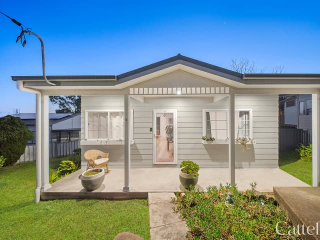
 Cathy Cattell

Price Guide $740,000 - $790,000
20 Mcarthur Street, Telarah NSW
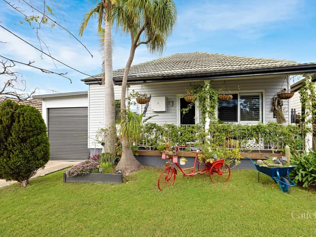 Cathy Cattell
Neg Range $795,000 - $855,000
6 Capp Street, Telarah NSW
Properties in Telarah

7 Capp Street
Leased Oct 2026 · $630 per week
3 bedrooms 1 bathroom

26 William Street
Leased Oct 2026 · $620 per week
4 bedrooms 1 bathroom 1 car space

24 Wentworth Street
Sold Oct 2026 · $740,000
3 bedrooms 2 bathrooms 1 car space 395 m² land
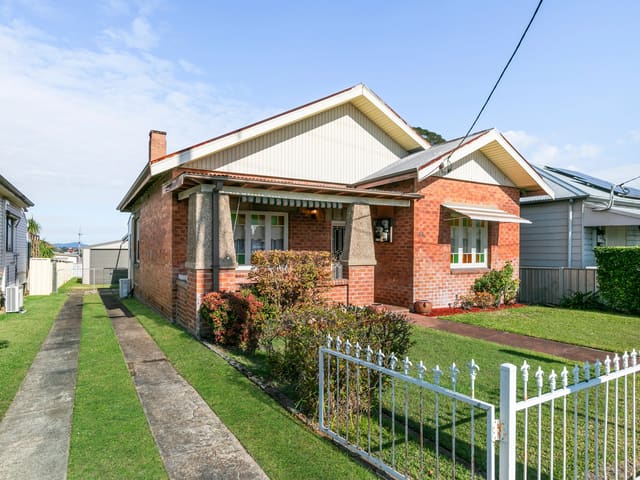
38 Telarah Street
Sold Sept 2026 · $720,000
3 bedrooms 1 bathroom 2 car spaces 537.5 m² land

20 Mcarthur Street
For sale since Sept 2026 · Price Guide $740,000 - $790,000
3 bedrooms 1 bathroom 1 car space 503 m² land

32 Elizabeth Street
Sold Aug 2026 · $770,000
3 bedrooms 1 bathroom 3 car spaces 811 m² land

6 Capp Street
For sale since June 2026 · Neg Range $795,000 - $855,000
3 bedrooms 1 bathroom 4 car spaces 571 m² land

21A Wentworth Street
Sold May 2026 · $600,000
3 bedrooms 1 bathroom 1 car space 444 m² land
24 Wentworth Street
Sold Oct 2026 · $740,000
3 bedrooms 2 bathrooms 1 car space 395 m² land
38 Telarah Street
Sold Sept 2026 · $720,000
3 bedrooms 1 bathroom 2 car spaces 537.5 m² land
32 Elizabeth Street
Sold Aug 2026 · $770,000
3 bedrooms 1 bathroom 3 car spaces 811 m² land
21A Wentworth Street
Sold May 2026 · $600,000
3 bedrooms 1 bathroom 1 car space 444 m² land

21 William Street
Sold Apr 2026 · $515,000
1 bedroom 1 bathroom 1 car space 303.5 m² land

47 Capp Street
Sold Mar 2026 · $753,000
3 bedrooms 2 bathrooms 1 car space 518 m² land

13 Elizabeth Street
Sold Mar 2026 · $670,000
2 bedrooms 1 bathroom 809.4 m² land

34 Mcdonald Street
Sold Oct 2025 · $805,000
3 bedrooms 1 bathroom 3 car spaces 859.96 m² land
Schools in Telarah
No primary schools in Telarah.
Hunter Trade College
IndependentSecondary
Local agents in Telarah


Zara Vivers
Sales Associate to Team Buckley River Realty
Sales Associate to Team Buckley River Realty - Maitland
Last 12 months
- Properties sold
- 66
- Median sold price
- $750k
- Median days on market
- 38

Chad Buckley
Property Sales Representative River Realty
Property Sales Representative River Realty - Maitland
Last 12 months
- Properties sold
- 82
- Median sold price
- $765k
- Median days on market
- 42

Sasha Roberts
Operations Manager Cattell Property Group
Last 12 months
- Properties sold
- 83
- Median sold price
- $850k
- Median days on market
- 42
Agencies that specialise in Telarah

Streets in Telarah
- Ada Street50 properties
- Bligh Street60 properties
- Bronwyn Street20 properties
- Brooks Street91 properties
- Bungaree Street15 properties
- Capp Street46 properties
- Capper Street83 properties
- Elizabeth Street38 properties
- George Street47 properties
- Goodlet Street3 properties
- Green Street48 properties
- Greta Street40 properties
- Ivor Street29 properties
- John Street11 properties
- Junction Street18 properties
- Kerrie Close66 properties
- Ledsam Street17 properties
- Lions Street18 properties
- Lismore Avenue14 properties
- Margaret Street3 properties
- Mcarthur Street26 properties
- Mcdonald Street33 properties
- Onus Street22 properties
- Parkes Street11 properties
- Railway Parade20 properties
- Raymond Street42 properties
- Russell Street30 properties
- Simpsons Lane7 properties
- South Street89 properties
- Taree Avenue51 properties
- Telarah Street65 properties
- Thomas Street44 properties
- Trevor Street19 properties
- Wentworth Street67 properties
- William Street35 properties
- Wollombi Road1 property
Neighbouring suburbs
Addresses and streets incorporate or were developed using G-NAF © Geoscape Australia, licensed by the Commonwealth of Australia under the Open Geo-coded National Address File (G-NAF) End User Licence Agreement.
Population and housing figures are drawn from the Australian Bureau of Statistics, Census of Population and Housing 2021, licensed under Creative Commons Attribution 4.0 International.
School details © Australian Curriculum, Assessment and Reporting Authority (ACARA), from the Australian Schools List, licensed under Creative Commons Attribution 4.0 International and modified. ACARA does not endorse Listd.
Area summaries are generated from the national address file and ABS Census data, and checked against those figures before publication.