
Suburb profile
Port Augusta West SA 5700
Port Augusta West is located in the Outback South Australia region of South Australia, postcode 5700. It has 2,450 properties across 118 streets, almost all houses. Explore every street in Port Augusta West, its property history, homes for sale and rent, who lives there, and the local agents.
About Port Augusta West
Port Augusta West, SA 5700, sits in Outback South Australia and neighbours Carriewerloo, Commissariat Point, Cultana and Emeroo. Its 118 streets hold 2,450 properties, 2,250 of them houses and 200 units.
Census figures are for Port Augusta, which covers the suburb. At the 2021 Census the area had 13,515 residents, a median age of 38 and an average household of 2.3 people. Median household income was $1,277 a week, the median mortgage repayment $1,138 a month and the median rent $200 a week. Of 4,993 dwellings, 3,986 were separate houses, 588 semi-detached, 361 flats and 42 other; 1,534 were owned outright, 1,395 owned with a mortgage and 1,899 rented.
Updated October 2026
Who lives in Port Augusta West
- 13,515Peoplelive in the area
- 38Median ageyears
- $1,277Median household incomea week
- $200Median renta week
Homes by type
- Houses3,986
- Townhouses and semis588
- Flats and apartments361
- Other42
Household
- Median mortgage repayment$1,138a month
- Household size2.3people on average
How homes are held
For sale and rent in Port Augusta West

 Peta Renshaw

$800,000 plus GST
76-80 Addison Road, Port Augusta West SA
 Peta Renshaw
Contact agent
Lot 7, 6 Cleary Street, Port Augusta West SA
Properties in Port Augusta West

3 Sherry Road
Sold June 2026 · $60,000
1,200 m² land
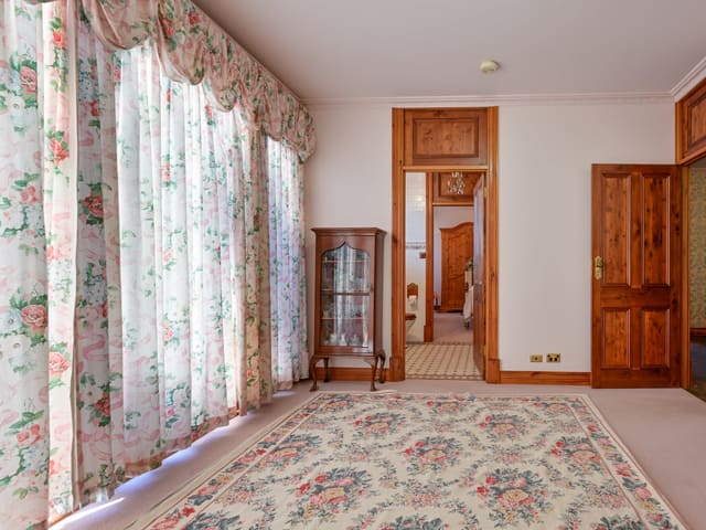
7 Cleary Street
Sold Apr 2026 · $680,000
5 bedrooms 3 bathrooms 13 car spaces 5,717 m² land

13/6 Cleary Street
Sold Feb 2026 · $140,000
957 m² land

6 Bryant Street
Sold Dec 2025 · $205,000
3 bedrooms 1 bathroom 2 car spaces 577 m² land

68 Bothwell Street
Sold Dec 2025 · $461,300
6 bedrooms 2 bathrooms 2 car spaces 1,390 m² land

5 Beer Street
Sold May 2025 · $180,000
689 m² land

68 Stokes Terrace
Sold Sept 2024 · $281,000
3 bedrooms 2 bathrooms 3 car spaces 733 m² land

76-80 Addison Road
For sale since July 2024 · $800,000 plus GST
5.3 ac land
3 Sherry Road
Sold June 2026 · $60,000
1,200 m² land
7 Cleary Street
Sold Apr 2026 · $680,000
5 bedrooms 3 bathrooms 13 car spaces 5,717 m² land
13/6 Cleary Street
Sold Feb 2026 · $140,000
957 m² land
6 Bryant Street
Sold Dec 2025 · $205,000
3 bedrooms 1 bathroom 2 car spaces 577 m² land
68 Bothwell Street
Sold Dec 2025 · $461,300
6 bedrooms 2 bathrooms 2 car spaces 1,390 m² land
5 Beer Street
Sold May 2025 · $180,000
689 m² land
68 Stokes Terrace
Sold Sept 2024 · $281,000
3 bedrooms 2 bathrooms 3 car spaces 733 m² land

50 Simmons Crescent
Sold July 2024 · $440,000
4 bedrooms 2 bathrooms 4 car spaces 695 m² land
Schools in Port Augusta West
Caritas College
CatholicPrimary and secondary
Flinders View Primary School
GovernmentPrimary
Port Augusta West Primary School
GovernmentPrimary
Caritas College
CatholicPrimary and secondary
Local agents in Port Augusta West
Peta Renshaw
Partner & Auctioneer Urban & Rural Partners
Last 12 months
- Properties sold
- 15
- Median sold price
- $461k
- Median days on market
- 71


Craig Costello
Property Consultant Harris Real Estate Kent Town
Property Consultant Harris Real Estate
Last 12 months
- Properties sold
- 36
- Median sold price
- $435k
- Median days on market
- 23
Agencies that specialise in Port Augusta West
Streets in Port Augusta West
A
B
- Baluch Road5 properties
- Barber Court10 properties
- Barrett Close13 properties
- Beer Street13 properties
- Bengtell Close18 properties
- Bond Street67 properties
- Bothwell Street11 properties
- Brett Court12 properties
- Bryant Street34 properties
- Burgoyne Street22 properties
- Burke Crescent38 properties
- Butler Crescent47 properties
C
D
E
F
G
H
I
K
L
M
- Madland Street7 properties
- Mathews Street61 properties
- Mccarthy Street39 properties
- Mcinerney Close8 properties
- Mcintosh Crescent28 properties
- Mckinnon Court3 properties
- Mcsporran Crescent76 properties
- Mellor Street66 properties
- Merrill Street3 properties
- Mildred Street63 properties
- Mitchell Terrace18 properties
- Mitford Court7 properties
- Mould Place6 properties
- Munro Court5 properties
N
O
P
R
S
- Sanderson Street9 properties
- Scharenberg Court7 properties
- Shack Road3 properties
- Shacks Road3 properties
- Sherry Road26 properties
- Shirley Street104 properties
- Simmons Crescent40 properties
- Slade Road29 properties
- Spring Court6 properties
- Stokes Terrace53 properties
- Stuart Highway6 properties
- Sunman Road6 properties
T
W
Y
Neighbouring suburbs
Addresses and streets incorporate or were developed using G-NAF © Geoscape Australia, licensed by the Commonwealth of Australia under the Open Geo-coded National Address File (G-NAF) End User Licence Agreement.
Population and housing figures are drawn from the Australian Bureau of Statistics, Census of Population and Housing 2021, licensed under Creative Commons Attribution 4.0 International.
School details © Australian Curriculum, Assessment and Reporting Authority (ACARA), from the Australian Schools List, licensed under Creative Commons Attribution 4.0 International and modified. ACARA does not endorse Listd.
Area summaries are generated from the national address file and ABS Census data, and checked against those figures before publication.