
Suburb profile
Newtown NSW 2042
Newtown is located in the Sydney City and Inner South region of New South Wales, postcode 2042. It has 10,732 properties across 122 streets. Explore every street in Newtown, its property history, homes for sale and rent, who lives there, and the local agents.
About Newtown
Newtown, NSW 2042, sits in the Sydney City and Inner South region and neighbours Camperdown, Enmore, Erskineville and Eveleigh. Its 122 streets hold 10,732 properties, 5,386 of them houses and 5,346 units.
At the 2021 Census Newtown had 14,667 residents, a median age of 34 and an average household of 2.1 people. Median household income was $2,325 a week, the median mortgage repayment $3,000 a month and the median rent $550 a week. Of 6,528 dwellings, 329 were separate houses, 3,395 semi-detached, 2,594 flats and 183 other; 1,117 were owned outright, 1,531 owned with a mortgage and 3,764 rented.
Updated October 2026
Who lives in Newtown
- 14,667Peoplelive in the area
- 34Median ageyears
- $2,325Median household incomea week
- $550Median renta week
Homes by type
- Houses329
- Townhouses and semis3,395
- Flats and apartments2,594
- Other183
Household
- Median mortgage repayment$3,000a month
- Household size2.1people on average
How homes are held
For sale and rent in Newtown
 Harris Partners Real Estate
Guide $435,000
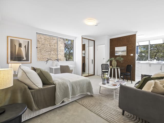
1/104 Alice Street, Newtown NSW 2042
Properties in Newtown

1/104 Alice Street
For sale since Sept 2026 · Guide $435,000
1 bathroom
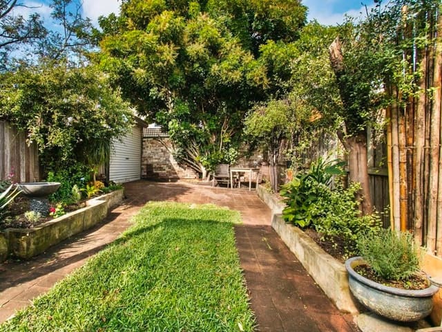
10 Alice Street
Sold Aug 2026 · $1,800,000
3 bedrooms 1 bathroom 1 car space 188 m² land

35 John Street
Leased Aug 2026 · $640 per week
1 bedroom 1 bathroom 1 car space

117/155 Missenden Road
Leased Aug 2026 · $750 per week
1 bedroom 1 bathroom 1 car space

117 Wilson Street
Leased July 2026 · $1,150 per week
3 bedrooms 2 bathrooms

40 Wilford Street
Leased July 2026 · Contact agent
2 bedrooms 1 bathroom

215/88 King Street
Leased July 2026 · $530 per week
1 bathroom

12/617-623 King Street
Leased May 2026 · $900 per week
2 bedrooms 2 bathrooms 1 car space
10 Alice Street
Sold Aug 2026 · $1,800,000
3 bedrooms 1 bathroom 1 car space 188 m² land

81A Probert Street
Sold June 2025 · $2,200,000
4 bedrooms 2 bathrooms 1 car space 127.3 m² land

77/155 Missenden Road
Sold June 2025 · Contact agent
1 bathroom 1 car space

27 Camden Street
Sold Jan 2024 · $1,350,000
1 bedroom 1 bathroom 107 m² land
Schools in Newtown
Australia Street Infants School
GovernmentPrimary
Camdenville Public School
GovernmentPrimary
Newtown North Public School
GovernmentPrimary
Newtown Public School
GovernmentPrimary
The Athena School
IndependentPrimary and secondary
Newtown High School of Performing Arts
GovernmentSecondary
The Athena School
IndependentPrimary and secondary
Local agents in Newtown

Ross Sorbello
Sales Consultant Harris Partners
Last 12 months
- Properties sold
- 18
- Median sold price
- $1.4m
- Median days on market
- 16

Peter O'Malley
Sales Consultant Harris Partners
Last 12 months
- Properties sold
- 56
- Median sold price
- $1.66m
- Median days on market
- 32


Claire Leeds
Customer Success Manager Warwick Williams Real Estate
Agencies that specialise in Newtown
All 8 agencies in Newtown

Streets in Newtown
A
B
- Bailey Street17 properties
- Baltic Street44 properties
- Bedford Street81 properties
- Bennett Street39 properties
- Bishopgate Street9 properties
- Brocks Lane86 properties
- Brown Lane7 properties
- Brown Street176 properties
- Buckland Lane2 properties
- Bucknell Lane2 properties
- Bucknell Street79 properties
- Burren Street44 properties
C
- Camden Street140 properties
- Campbell Street65 properties
- Carillon Avenue791 properties
- Chalder Street12 properties
- Chelmsford Street122 properties
- Church Street105 properties
- Clara Street14 properties
- College Street36 properties
- Commodore Street63 properties
- Copeland Avenue7 properties
- Crescent Lane1 property
D
E
F
G
H
I
J
K
L
M
N
O
P
Q
R
S
T
U
V
W
Y
Neighbouring suburbs
Addresses and streets incorporate or were developed using G-NAF © Geoscape Australia, licensed by the Commonwealth of Australia under the Open Geo-coded National Address File (G-NAF) End User Licence Agreement.
Population and housing figures are drawn from the Australian Bureau of Statistics, Census of Population and Housing 2021, licensed under Creative Commons Attribution 4.0 International.
School details © Australian Curriculum, Assessment and Reporting Authority (ACARA), from the Australian Schools List, licensed under Creative Commons Attribution 4.0 International and modified. ACARA does not endorse Listd.
Area summaries are generated from the national address file and ABS Census data, and checked against those figures before publication.