
Suburb profile
Morpeth NSW 2321
Morpeth is located in the Hunter Valley region of New South Wales, postcode 2321. It has 1,108 properties across 34 streets. Explore every street in Morpeth, its property history, homes for sale and rent, who lives there, and the local agents.
About Morpeth
Morpeth, NSW 2321, sits in the Hunter Valley region and neighbours Berry Park, Chisholm, Raworth and Tenambit. Its 34 streets hold 1,108 properties, 740 of them houses and 368 units.
Census figures are for Tenambit - East Maitland, which covers Morpeth. The area has 10,091 residents, a median age of 41 and an average household of 2.4 people. Median household income is $1,426 a week, the median mortgage repayment $1,733 a month and the median rent $360 a week. Of 4,089 dwellings, 3,276 were separate houses, 675 semi-detached and 134 flats; 1,367 were owned outright, 1,323 owned with a mortgage and 1,156 rented.
Updated October 2026
Who lives in Morpeth
- 10,091Peoplelive in the area
- 41Median ageyears
- $1,426Median household incomea week
- $360Median renta week
Homes by type
- Houses3,276
- Townhouses and semis675
- Flats and apartments134
Household
- Median mortgage repayment$1,733a month
- Household size2.4people on average
How homes are held
For sale and rent in Morpeth
 Tom Cohen
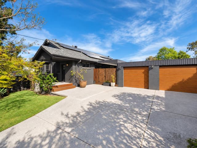
Guide $1,349,000 - $1,390,000
3 James Street, Morpeth NSW 2321
 Tom Cohen
Guide $949,000 - $979,000
44 Close Street, Morpeth NSW 2321

 Dee Martin
$290 pw
2/131 Swan Street, Morpeth NSW 2321
Available now
Properties in Morpeth

3 James Street
For sale since Oct 2026 · Guide $1,349,000 - $1,390,000
4 bedrooms 2 bathrooms 2 car spaces 939.9 m² land
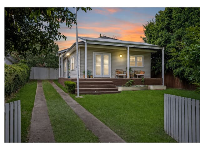
103 Swan Street
Sold Sept 2026 · Contact agent
3 bedrooms 2 bathrooms 2 car spaces 450.6 m² land

85 High Street
Sold July 2026 · $780,000
2 bedrooms 1 bathroom 923.2 m² land
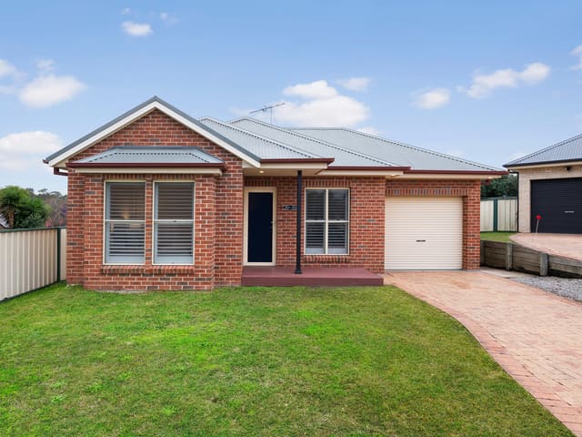
3 Lincoln Close
Sold July 2026 · $820,000
3 bedrooms 1 bathroom 1 car space 458.4 m² land

64 High Street
Sold July 2026 · $730,000
2 bedrooms 1 bathroom 670 m² land

44 Close Street
For sale since June 2026 · Guide $949,000 - $979,000
3 bedrooms 1 bathroom 4 car spaces 569 m² land

107 Close Street
Sold May 2026 · $970,000
3 bedrooms 1 bathroom 2 car spaces 461.6 m² land

13 James Street
Sold May 2026 · $1,050,000
4 bedrooms 2 bathrooms 1 car space 714.5 m² land
103 Swan Street
Sold Sept 2026 · Contact agent
3 bedrooms 2 bathrooms 2 car spaces 450.6 m² land
85 High Street
Sold July 2026 · $780,000
2 bedrooms 1 bathroom 923.2 m² land
3 Lincoln Close
Sold July 2026 · $820,000
3 bedrooms 1 bathroom 1 car space 458.4 m² land
64 High Street
Sold July 2026 · $730,000
2 bedrooms 1 bathroom 670 m² land
107 Close Street
Sold May 2026 · $970,000
3 bedrooms 1 bathroom 2 car spaces 461.6 m² land
13 James Street
Sold May 2026 · $1,050,000
4 bedrooms 2 bathrooms 1 car space 714.5 m² land

116 Princess Street
Sold Apr 2026 · $640,000
3 bedrooms 3 bathrooms 1 car space 411.6 m² land

53 Close Street
Sold Apr 2026 · $785,000
3 bedrooms 1 bathroom 1 car space 602.6 m² land
Schools in Morpeth
Morpeth Public School
GovernmentPrimary
No secondary schools in Morpeth.
Local agents in Morpeth
Tom Cohen
Property Sales Representative River Realty
Property Sales Representative River Realty - Maitland
Last 12 months
- Properties sold
- 34
- Median sold price
- $820k
- Median days on market
- 24

Chris Henry
Managing Director / Sales Representative River Realty
Managing Director / Sales Representative River Realty - Maitland
Last 12 months
- Properties sold
- 61
- Median sold price
- $1.15m
- Median days on market
- 35

Maddison Woodward
Property Sales Representative River Realty
Property Sales Representative River Realty - Maitland
Last 12 months
- Properties sold
- 54
- Median sold price
- $1.17m
- Median days on market
- 33
Agencies that specialise in Morpeth
Streets in Morpeth
- Albuera Close12 properties
- Berkley Street4 properties
- Brisbane Fields Road4 properties
- Butchers Lane4 properties
- Canterbury Drive21 properties
- Carlisle Place30 properties
- Close Street73 properties
- Duckenfield Road12 properties
- Duke Street6 properties
- Edward Close Boulevard1 property
- Edward Street32 properties
- Elizabeth Street1 property
- George Street13 properties
- Green Street7 properties
- High Street114 properties
- James Street85 properties
- John Street9 properties
- Lincoln Close12 properties
- Little James Street1 property
- London Avenue30 properties
- Market Street1 property
- Matilda Circle22 properties
- Morpeth Road283 properties
- Northumberland Street10 properties
- Oxford Place6 properties
- Palmer Lane3 properties
- Princess Street59 properties
- Queens Wharf Road2 properties
- Robert Street13 properties
- St Albans Place5 properties
- Steamer Street1 property
- Susannah Lane4 properties
- Swan Street219 properties
- Tank Street9 properties
Neighbouring suburbs
Addresses and streets incorporate or were developed using G-NAF © Geoscape Australia, licensed by the Commonwealth of Australia under the Open Geo-coded National Address File (G-NAF) End User Licence Agreement.
Population and housing figures are drawn from the Australian Bureau of Statistics, Census of Population and Housing 2021, licensed under Creative Commons Attribution 4.0 International.
School details © Australian Curriculum, Assessment and Reporting Authority (ACARA), from the Australian Schools List, licensed under Creative Commons Attribution 4.0 International and modified. ACARA does not endorse Listd.
Area summaries are generated from the national address file and ABS Census data, and checked against those figures before publication.