
Suburb profile
Mannum SA 5238
Mannum is located in the South East South Australia region of South Australia, postcode 5238. It has 2,413 properties across 124 streets, mostly houses. Explore every street in Mannum, its property history, homes for sale and rent, who lives there, and the local agents.
About Mannum
Mannum, SA 5238, sits in the South East South Australia region and neighbours Apamurra, Bolto, Cambrai and Cowirra. Its 124 streets hold 2,413 properties, 2,107 of them houses and 306 units.
At the Census Mannum had 6,594 residents, a median age of 55 and an average household of 2.1 people. Median household income was $901 a week, the median mortgage repayment $1,083 a month and the median rent $215 a week. Of 2,801 dwellings, 2,631 were separate houses, 60 semi-detached, 13 flats and 89 other; 1,370 were owned outright, 835 owned with a mortgage and 473 rented.
Updated October 2026
Who lives in Mannum
- 6,594Peoplelive in the area
- 55Median ageyears
- $901Median household incomea week
- $215Median renta week
Homes by type
- Houses2,631
- Townhouses and semis60
- Flats and apartments13
- Other89
Household
- Median mortgage repayment$1,083a month
- Household size2.1people on average
How homes are held
For sale and rent in Mannum

 Nigel Christie

By Negotiation - $700,000 - $750,000
Lot 454 Marina Way, Mannum SA

 Paul Richards

$199,500
Lot 331, Rosella Rise, Mannum SA 5238
 Nigel Christie
$300,000 - $330,000
Lot 811 Marina Way, Mannum SA
Properties in Mannum

Marina Way
For sale since Sept 2026 · By Negotiation - $700,000 - $750,000
1,122 m² land

Rosella Rise
For sale since Sept 2026 · $199,500
524 m² land
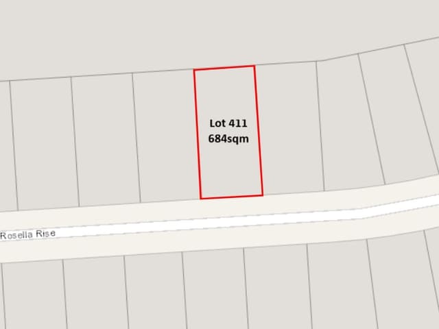
411 Rosella Rise
Sold Aug 2026 · $250,000
684 m² land

Marina Way
For sale since Aug 2026 · $300,000 - $330,000
666 m² land

Marina Way
For sale since May 2026 · $300,000 - $330,000
667 m² land

108 Marina Way
Sold Apr 2026 · $1,135,000
4 bedrooms 2 bathrooms 2 car spaces 1,062 m² land

35 Marina Way
Sold Aug 2025 · Contact agent
1,039 m² land

16 Rosella Rise
Sold May 2025 · $115,000
356 m² land
411 Rosella Rise
Sold Aug 2026 · $250,000
684 m² land
108 Marina Way
Sold Apr 2026 · $1,135,000
4 bedrooms 2 bathrooms 2 car spaces 1,062 m² land
35 Marina Way
Sold Aug 2025 · Contact agent
1,039 m² land
16 Rosella Rise
Sold May 2025 · $115,000
356 m² land

18 Rosella Rise
Sold Dec 2024 · $90,000
367 m² land

10 Rosella Rise
Sold Aug 2024 · $95,000
630 m² land

42 Berryman Avenue
Sold Nov 2023 · $473,000
3 bedrooms 2 bathrooms 10 car spaces 2,020 m² land

110 Marina Way
Sold Oct 2023 · $270,000
1,060 m² land
Schools in Mannum
Mannum Community College
GovernmentPrimary and secondary
Mannum Community College
GovernmentPrimary and secondary
Local agents in Mannum
Nigel Christie
Rural Sales Partner Urban & Rural Partners
Last 12 months
- Properties sold
- 28
- Median sold price
- $528k
- Median days on market
- 102
Last 12 months
- Properties sold
- 46
- Median sold price
- $772k
- Median days on market
- 15

Last 12 months
- Properties sold
- 47
- Median sold price
- $772k
- Median days on market
- 15

Agencies that specialise in Mannum
Streets in Mannum
A
B
- Banks Street16 properties
- Banksia Street1 property
- Barley Drive18 properties
- Baseby Road15 properties
- Baseby Street14 properties
- Belvedere Road18 properties
- Berryman Avenue46 properties
- Boomerang Avenue17 properties
- Bormann Avenue17 properties
- Bretag Street26 properties
- Budarick Road7 properties
- Bunyip Way14 properties
- Busch Street17 properties
C
D
E
F
G
H
I
J
K
L
M
- Magpie Crescent21 properties
- Male Road28 properties
- Mannum Road9 properties
- Margaret Street2 properties
- Marina Way83 properties
- Marks Road2 properties
- Mary Ann Street3 properties
- Mau Street23 properties
- Mclaren Street1 property
- Monument Corner Crescent4 properties
- Murray Crescent7 properties
- Murray Park76 properties
- Murraylands Road3 properties
- Myall Place5 properties
N
O
P
Q
R
S
- Salisbury Road2 properties
- Scheer Street2 properties
- Schmaals Road3 properties
- Schuetze Street6 properties
- Shearer Heights Road6 properties
- Shearer Street15 properties
- Sickerdick Street28 properties
- Spoonbill Court39 properties
- Springs Road2 properties
- Stanley Fahey Drive10 properties
- Stephen Close5 properties
- Stockwell Road2 properties
- Summit Road3 properties
- Susan Court3 properties
V
W
Y
Neighbouring suburbs
Addresses and streets incorporate or were developed using G-NAF © Geoscape Australia, licensed by the Commonwealth of Australia under the Open Geo-coded National Address File (G-NAF) End User Licence Agreement.
Population and housing figures are drawn from the Australian Bureau of Statistics, Census of Population and Housing 2021, licensed under Creative Commons Attribution 4.0 International.
School details © Australian Curriculum, Assessment and Reporting Authority (ACARA), from the Australian Schools List, licensed under Creative Commons Attribution 4.0 International and modified. ACARA does not endorse Listd.
Area summaries are generated from the national address file and ABS Census data, and checked against those figures before publication.