
Suburb profile
Eastgardens NSW 2036
Eastgardens is located in the Sydney City and Inner South region of New South Wales, postcode 2036. It has 3,707 properties across 17 streets, mostly units. Explore every street in Eastgardens, its property history, homes for sale and rent, who lives there, and the local agents.
About Eastgardens
Eastgardens, NSW 2036, sits in the Sydney City and Inner South region and neighbours Banksmeadow, Maroubra, Pagewood and Hillsdale. Its 17 streets hold 3,707 properties, 3,278 of them units and 429 houses.
Census figures are for the area Pagewood - Hillsdale - Daceyville, which had 14,762 residents, a median age of 35 and an average household of 2.4 people. Median household income was $1,808 a week, the median mortgage repayment $2,600 a month and the median rent $495 a week. Of 5,684 dwellings, 3,520 were flats, 1,406 separate houses, 740 semi-detached and 3 other; 2,911 were rented, 1,408 owned with a mortgage and 1,208 owned outright.
Updated October 2026
Who lives in Eastgardens
- 14,762Peoplelive in the area
- 35Median ageyears
- $1,808Median household incomea week
- $495Median renta week
Homes by type
- Houses1,406
- Townhouses and semis740
- Flats and apartments3,520
- Other3
Household
- Median mortgage repayment$2,600a month
- Household size2.4people on average
How homes are held
For sale and rent in Eastgardens
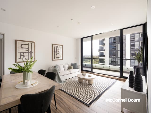
 Jason Zhuang

Contact Agent
915/15 Oscar Place, Eastgardens NSW 2036
Inspect today 12:20pm
 Jason Zhuang
$1,450,000 - $1,550,000
1316/15 Oscar Place, Eastgardens NSW 2036
Inspect today 12:00pm
Properties in Eastgardens

915/15 Oscar Place
For sale since Oct 2026 · Contact agent
2 bedrooms 2 bathrooms 1 car space

1316/15 Oscar Place
For sale since Sept 2026 · $1,450,000 - $1,550,000
3 bedrooms 2 bathrooms 2 car spaces

1838/1 Finch Drive
Sold Sept 2025 · $1,720,000
4 bedrooms 2 bathrooms 2 car spaces

422/15 Oscar Place
Sold July 2025 · $1,030,000
2 bedrooms 2 bathrooms 2 car spaces

619/15 Oscar Place
Sold Feb 2025 · $1,700,000
3 bedrooms 2 bathrooms 2 car spaces

228/13 Oscar Place
Sold Nov 2024 · $905,000
2 bedrooms 2 bathrooms 1 car space

909/3 Finch Drive
Sold Nov 2023 · $925,000
2 bedrooms 2 bathrooms 1 car space

1415/15 Oscar Place
Sold Mar 2023 · $1,120,000
2 bedrooms 2 bathrooms 2 car spaces
1838/1 Finch Drive
Sold Sept 2025 · $1,720,000
4 bedrooms 2 bathrooms 2 car spaces
422/15 Oscar Place
Sold July 2025 · $1,030,000
2 bedrooms 2 bathrooms 2 car spaces
619/15 Oscar Place
Sold Feb 2025 · $1,700,000
3 bedrooms 2 bathrooms 2 car spaces
228/13 Oscar Place
Sold Nov 2024 · $905,000
2 bedrooms 2 bathrooms 1 car space
909/3 Finch Drive
Sold Nov 2023 · $925,000
2 bedrooms 2 bathrooms 1 car space
1415/15 Oscar Place
Sold Mar 2023 · $1,120,000
2 bedrooms 2 bathrooms 2 car spaces

232/13 Oscar Place
Sold Jan 2023 · $748,000
1 bedroom 1 bathroom 1 car space

1640/1 Finch Drive
Sold Jan 2022 · $1,450,888
4 bedrooms 2 bathrooms 2 car spaces 172 m² land
Local agents in Eastgardens

Wendy Zhang
Licensed Real Estate Agent McConnell Bourn Sydney
Last 12 months
- Properties sold
- 10
- Median sold price
- $1.34m
- Median days on market
- 50
Jason Zhuang
Licensed Real Estate Agent McConnell Bourn Sydney
Last 12 months
- Properties sold
- 22
- Median sold price
- $982k
- Median days on market
- 8

Justin Ruan
Licensed Real Estate Agent McConnell Bourn Sydney
Last 12 months
- Properties sold
- 33
- Median sold price
- $982k
- Median days on market
- 29
Agencies that specialise in Eastgardens
Streets in Eastgardens
- Banks Avenue632 properties
- Boonah Avenue61 properties
- Bunnerong Road462 properties
- Corish Circle2 properties
- Delma Drive15 properties
- Finch Drive1,221 properties
- Flint Street15 properties
- Fraser Avenue62 properties
- Heffron Road28 properties
- Mathewson Street35 properties
- Oscar Place454 properties
- Rhodes Street3 properties
- Smith Street45 properties
- Studio Drive590 properties
- Tierney Avenue40 properties
- Tingwell Boulevard5 properties
- Wentworth Avenue37 properties
Neighbouring suburbs
Addresses and streets incorporate or were developed using G-NAF © Geoscape Australia, licensed by the Commonwealth of Australia under the Open Geo-coded National Address File (G-NAF) End User Licence Agreement.
Population and housing figures are drawn from the Australian Bureau of Statistics, Census of Population and Housing 2021, licensed under Creative Commons Attribution 4.0 International.
Area summaries are generated from the national address file and ABS Census data, and checked against those figures before publication.