
57 Daly Street, Wallaroo SA 5556
- 3 bed
- 1 bath
- 462 m² land
- 100 m² floor area
- House
About this property
57 Daly Street is a 3-bedroom house in Wallaroo SA 5556 on a 462 m² block. It last sold in February 2026 for $291,000 through Harris Real Estate Kent Town, 14 days after it was listed. Wallaroo is in the Barossa, Yorke and Mid North region. The nearest school, primary and secondary, is St Mary MacKillop School (Catholic), about 800 m away in a straight line.
Property features
- Bedrooms: 3
- Bathrooms: 1
- Car spaces: –
- Property type: House
- Land size: 462 m²
- Building/floor size: 100 m²
- Year built: –
Property location
Nearby schools
- 800 m
St Mary MacKillop School
CatholicPrimary and secondary
- 1.2 km
Wallaroo Primary School
GovernmentPrimary
- 6.7 km
Wallaroo Mines Primary School
GovernmentPrimary
- 7.3 km
Kadina Memorial School
GovernmentPrimary and secondary
- 7.4 km
Harvest Christian College
IndependentPrimary and secondary
- 800 m
St Mary MacKillop School
CatholicPrimary and secondary
- 7.3 km
Kadina Memorial School
GovernmentPrimary and secondary
- 7.4 km
Harvest Christian College
IndependentPrimary and secondary
Property history
Local market activity
Recent listings in Wallaroo.
For sale
For sale in Wallaroo →For rent
For rent in Wallaroo →Local agents in Wallaroo


Craig Costello
Property Consultant Harris Real Estate Kent Town
Property Consultant Harris Real Estate
Last 12 months
- Properties sold
- 36
- Median sold price
- $435k
- Median days on market
- 23

Peta Renshaw
Partner & Auctioneer Urban & Rural Partners
Last 12 months
- Properties sold
- 15
- Median sold price
- $461k
- Median days on market
- 71

Last 12 months
- Properties sold
- 32
- Median sold price
- $835k
- Median days on market
- 19
Who lives in Wallaroo
- 4,426Peoplelive in the area
- 56Median ageyears
Homes by type
How homes are held
Neighbouring properties
Every property on Daly Street →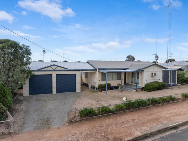
Prices and dates as published by the listing agency.
Addresses and streets incorporate or were developed using G-NAF © Geoscape Australia, licensed by the Commonwealth of Australia under the Open Geo-coded National Address File (G-NAF) End User Licence Agreement.
Population and housing figures are drawn from the Australian Bureau of Statistics, Census of Population and Housing 2021, licensed under Creative Commons Attribution 4.0 International.
School details © Australian Curriculum, Assessment and Reporting Authority (ACARA), from the Australian Schools List, licensed under Creative Commons Attribution 4.0 International and modified. ACARA does not endorse Listd.